Cheyenne Wells & Smoky Creek Fields
- Discovered in 1968
- Produced in excess of 8 Million barrels of oil
- Produces primarily from Mississippian Spergen Dolomite
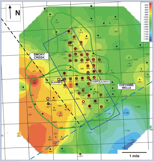
Structure map on the base of the Morrow Shale/ top of Keyes Formation (BMS/KYS). Spergen producers (red), field outlines (green), 3-D seismic area (blue), high-angle basement fault (dashed black), and Precambrian shear zone (dashed blue) are shown. Wells with core are labeled.
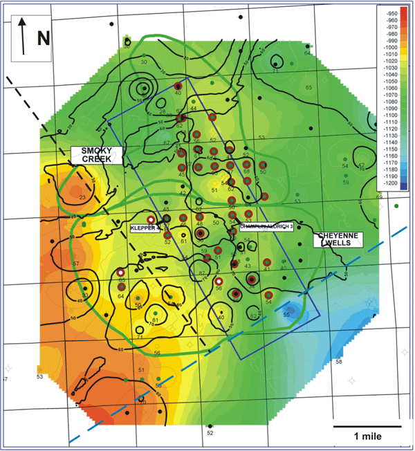
Structure map on top of the St. Louis (color filled contours) corresponding to the Mississippian Unconformity surface, with isopach of the Keyes interval and the top of the St. Louis superimposed (black, 5 ft. contour interval). Numbers are isopach thickness. The Keyes is the basal Pennsylvanian accumulation in the area and thicks in this isopach may represent fill of local depressions on the unconformity surface.
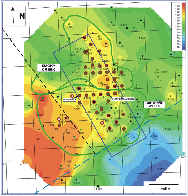
Structure map on top of the Spergen. Legend as on BMS/KYS map above.
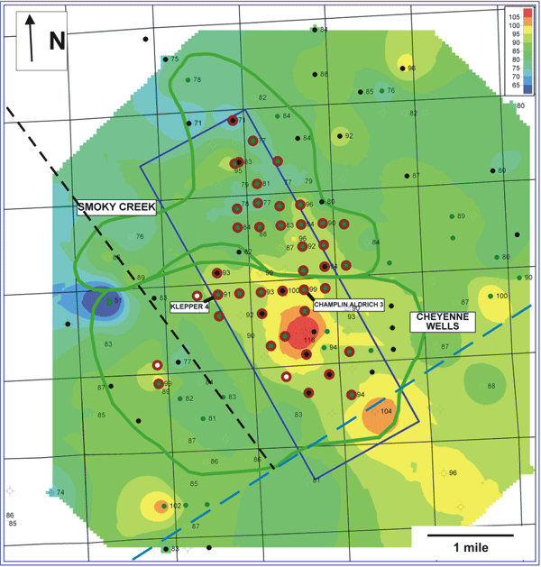
Isopach of Gross Spergen thickness. Legend as on BMS/KYS map above.
Structure and Isopach Maps
- Precambrian shear zone and basement faults (Sims et al., 2001) bound low and high areas on the structure maps.
- Spergen production sits on a structural high with an apparent overall northeasterly trend in the Cheyenne Wells field and a north to northwesterly trend in the Smoky Creek field.
- St. Louis structure and Keyes isopach maps show areas of possible pre-Pennsylvanian karst (?) depressions on top of the St. Louis.
- Local depressions on the high have relative depth up to
approximately 65 ft.
Spergen varies from 51 to 116 ft in thickness in the study area, with the thickest Spergen occurring in a northwest-trending band covering the eastern portion of Cheyenne Wells field.
http://www.kgs.ku.edu/PRS/publication/2006/2006-14/p1-02.html
Last Modified May 2006