Coal Distribution
The thickness and distribution of coal is influenced by both the tectonic and structural setting, as well as the depositional environment in which peat accumulates.
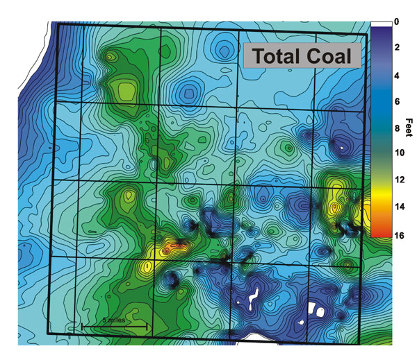
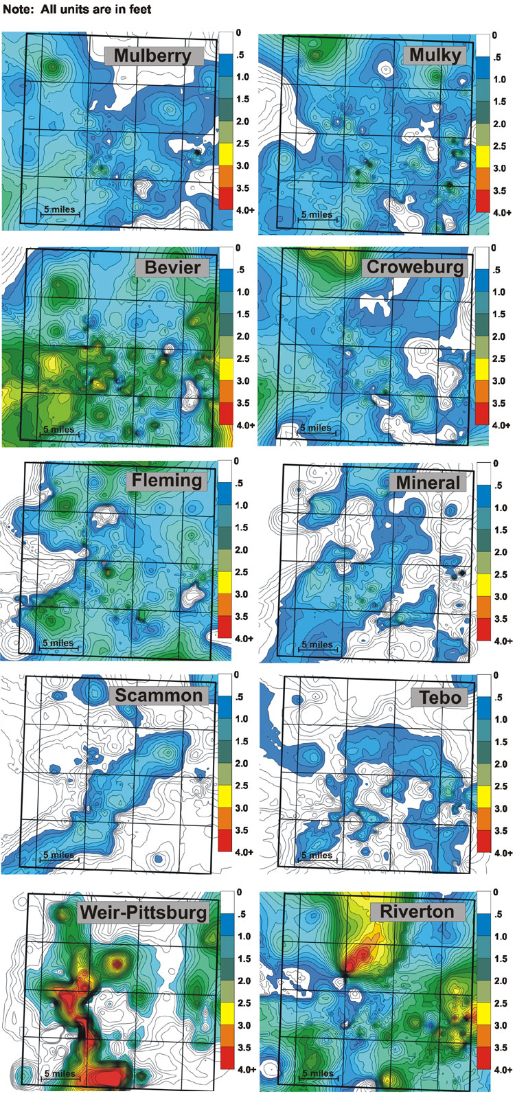
The Cherokee and Marmaton groups of southeastern Kansas contain upwards of 20 named coals, as well as several more that are unnamed. The distribution and lateral continuity of many of these coals is such that commonly less than half are found in any one locality. These coals are commonly less than two feet in thickness, and rarely exceed five feet. General practice in industry is that a coal must be a half of a foot thick before it is considered viable for CBNG production. With the abundance of new wells being drilled targeting these coals, it is becoming apparent that the distribution of many of these coals is much more variable than once thought.
Comparison of coal isopachs to the structure on the top of the Mississippian indicates total coal thickness tends to be the greatest on the structural highs. These highs likely provided the correct balance of conditions for accumulating larger quantities of coal-forming peat, or possibly control reducing sedimentary processes that would reduce or remove peat accumulations.
http://www.kgs.ku.edu/PRS/publication/2006/2006-13/p2-01.html
Last Modified May 2006