
|
Depositional Model and Exploration Potential in the
St. Louis Carbonates Beneath the Hugoton Field of Kansas
|

Kansas Geological Survey
Open-file Report 2002-8 |
Pleasant Prairie Pool Study Model and Analagous Pool
Studies
Archer Field
Description
T34S-R34W Sections 26,27,34,35
T35S-R34W Sections 2,11
Method of Exploration
The discovery well in the St. Louis formation for the Archer Field
was the Anadarko #1 Lenehan 'A' in the SW NE Section 27-34-34W.
Development of the field occurred in two phases. The initial
development of the field is presumed to have been done on a combination
of 2-D seismic and drilling a Winfield structural nose. The later
development of the field occurred after 3-D seismic had been shot.
Nature of Trap
Production occurs in multiple shoaling events in the St. Louis
formation and is associated with a south plunging structural anticline.
The east side of the field is fault controlled while loss of
reservoir controls the northwest side. To the east, on the down
side of the fault, a Chester age incised valley is present and
productive. Also, along the down side of the fault, thick Morrowan
sediments were deposited and produce.
Lithology of the Pay Zone
The St. Louis formation consists of multiple shoals that are highly
oolitic bounded both vertically and laterally by limestone that
is dense, fine crystalline and slightly chalky. Fracturing is
possible within the field, particularly in wells near the fault.
This fracturing is believed to enhance the reservoir capacity
and interconnects the various shoaling events.
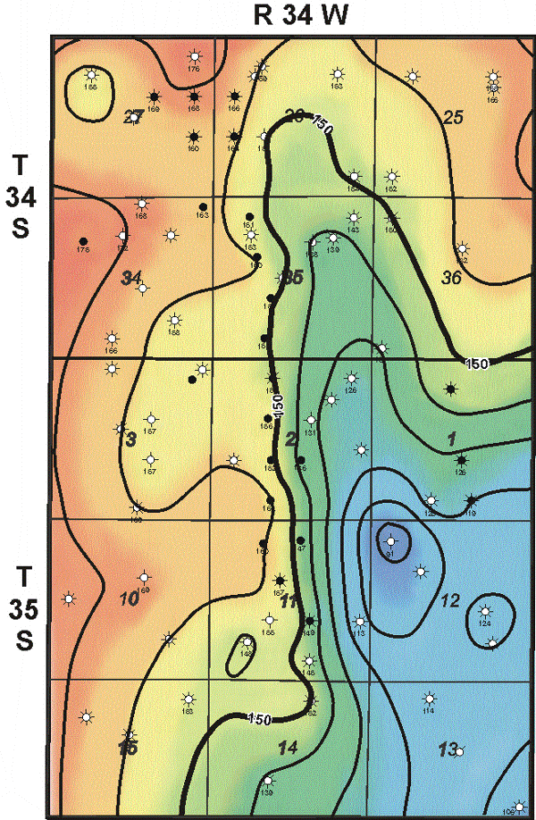 |
Winfield Structure
Contour Interval = 10 feet |
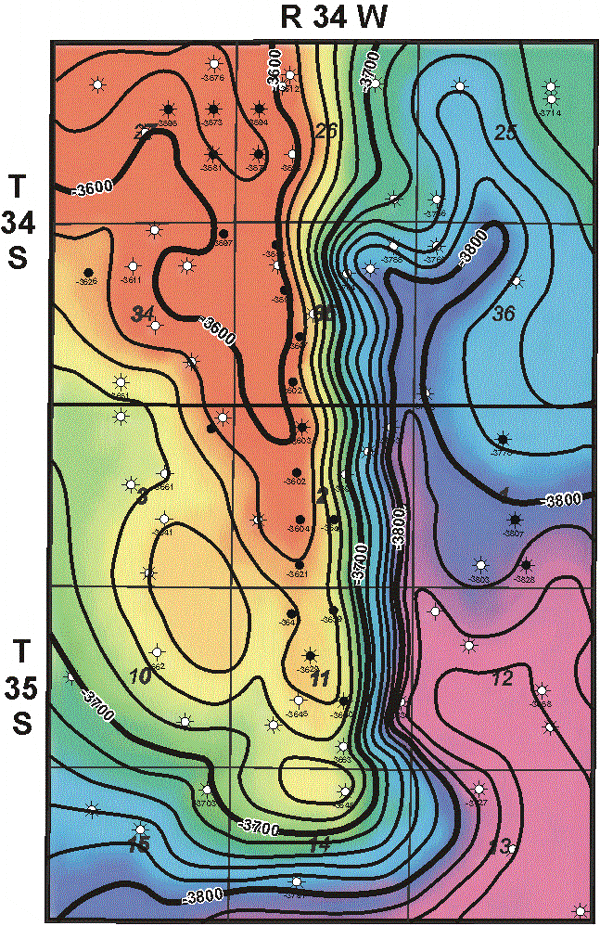 |
St. Louis Structure
Contour Interval = 10 feet |
e-mail : webadmin@kgs.ku.edu
Last updated March 2002
http://www.kgs.ku.edu/PRS/Poster/2002/2002-10/P2-03.html