
Characterization of Mississippian Osage Chat in South-Central
Kansas
Kansas Geological Survey
Open-file Report 2002-50
|
|
|
Kansas Geological Survey Open-file Report 2002-50 |
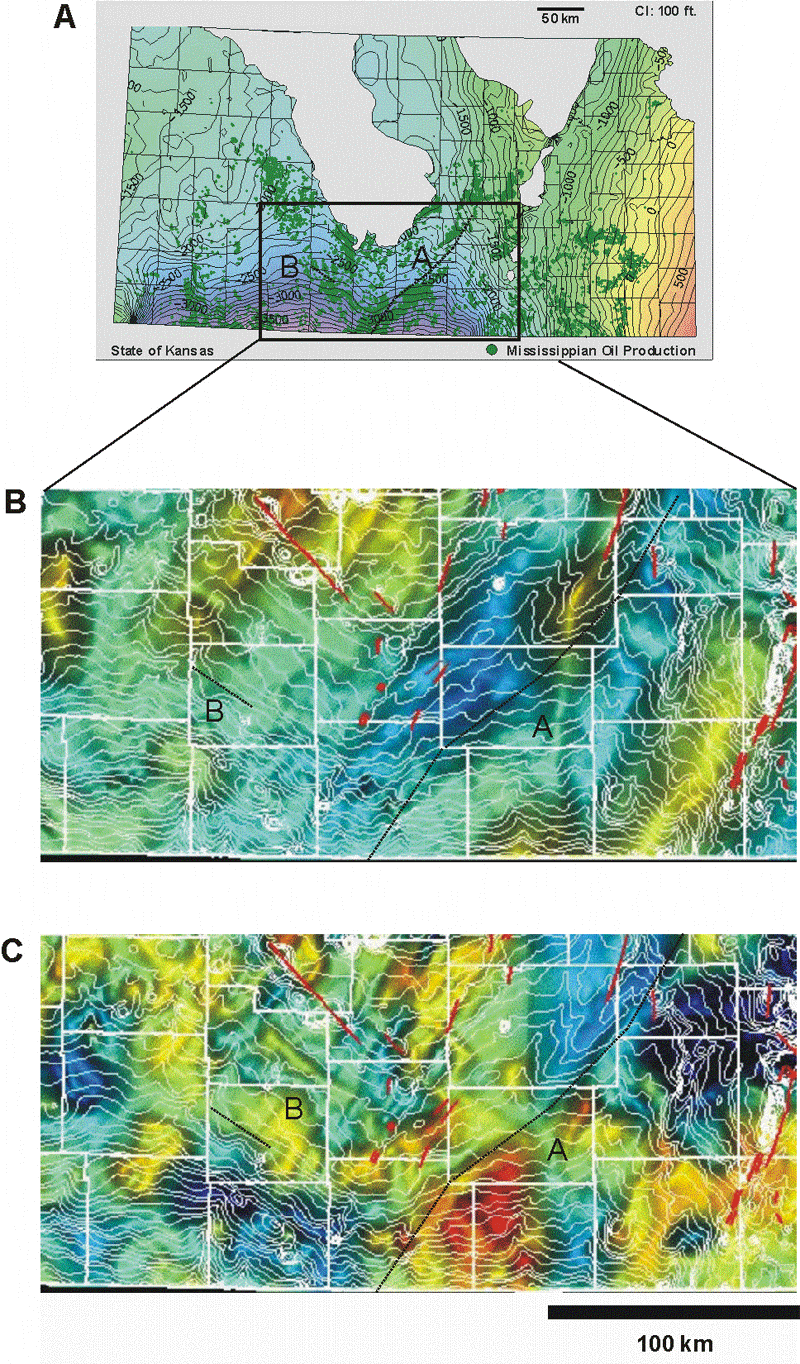
Structural contour map on top of the Mississippian with oil production (Gerlach, 1998b). Lineaments "A" and "B" are shown. B. Map of Bouguer gravity overlain with contours of the surface of the Precambrian from Cole (1976). Blues represent lowest residuals and reds represent highest residual values. These colored images are displayed with apparent relief created by vertical illumination. Steeper gradients are indicated by darker shading. (Kruger, 1997). C. Map of reduced-to-the-pole magnetic field displayed in similar way as gravity data (Kruger, 1997).
|
|
|