| Year | Oil | Gas | ||||
|---|---|---|---|---|---|---|
| Production (bbls) |
Wells | Cumulative (bbls) |
Production (mcf) |
Wells | Cumulative (mcf) |
|
| 1995 | 81,091 | 361 | 36,052,348 | 60,782 | 26 | 1,745,805 |
| 1996 | 79,122 | 946 | 36,131,470 | 100,597 | 56 | 1,846,402 |
| 1997 | 73,599 | 844 | 36,205,069 | 117,261 | 62 | 1,963,663 |
| 1998 | 58,307 | 852 | 36,263,376 | 125,556 | 61 | 2,089,219 |
| 1999 | 41,558 | 786 | 36,304,934 | 138,999 | 59 | 2,228,218 |
| 2000 | 48,025 | 860 | 36,352,959 | 151,271 | 48 | 2,379,489 |
| 2001 | 45,035 | 788 | 36,397,994 | 652,928 | 60 | 3,032,417 |
| 2002 | 43,153 | 735 | 36,441,147 | 1,931,245 | 163 | 4,963,662 |
| 2003 | 42,357 | 680 | 36,483,504 | 4,241,821 | 229 | 9,205,483 |
| 2004 | 39,986 | 688 | 36,523,490 | 4,576,999 | 360 | 13,782,482 |
| 2005 | 42,448 | 680 | 36,565,938 | 5,333,073 | 458 | 19,115,555 |
| 2006 | 44,464 | 711 | 36,610,402 | 7,889,349 | 761 | 27,004,904 |
| 2007 | 38,240 | 653 | 36,648,642 | 10,909,680 | 1126 | 37,914,584 |
| 2008 | 38,538 | 655 | 36,687,180 | 14,303,809 | 1380 | 52,218,393 |
| 2009 | 36,335 | 649 | 36,723,515 | 14,469,668 | 1350 | 66,688,061 |
| 2010 | 28,773 | 622 | 36,752,288 | 12,940,892 | 1281 | 79,628,953 |
| 2011 | 28,174 | 690 | 36,780,462 | 12,089,122 | 1322 | 91,718,075 |
| 2012 | 38,063 | 752 | 36,818,525 | 10,820,236 | 1299 | 102,538,311 |
| 2013 | 73,245 | 792 | 36,891,770 | 9,561,067 | 1287 | 112,099,378 |
| 2014 | 60,316 | 850 | 36,952,086 | 8,577,371 | 1286 | 120,676,749 |
| 2015 | 48,658 | 835 | 37,000,744 | 8,066,523 | 1238 | 128,743,272 |
| 2016 | 40,237 | 827 | 37,040,981 | 7,354,480 | 1190 | 136,097,752 |
| 2017 | 36,528 | 841 | 37,077,509 | 6,595,224 | 1158 | 142,692,976 |
| 2018 | 30,391 | 768 | 37,107,900 | 5,755,673 | 1135 | 148,448,649 |
| 2019 | 26,483 | 792 | 37,134,383 | 5,142,593 | 1092 | 153,591,242 |
| 2020 | 25,425 | 668 | 37,159,808 | 4,567,086 | 1048 | 158,158,328 |
| 2021 | 20,932 | 653 | 37,180,740 | 4,098,382 | 1015 | 162,256,710 |
| 2022 | 18,997 | 660 | 37,199,737 | 3,794,777 | 1005 | 166,051,487 |
| 2023 | 21,687 | 676 | 37,221,424 | 3,526,161 | 991 | 169,577,648 |
| 2024 | 18,878 | 617 | 37,240,302 | 3,070,944 | 976 | 172,648,592 |
| 2025 | 13,268 | 491 | 37,253,570 | 2,130,326 | 885 | 174,778,918 |

Abandoned
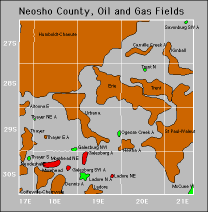
Canville Creek
Galesburg
Hertha