| Year | Oil | Gas | ||||
|---|---|---|---|---|---|---|
| Production (bbls) |
Wells | Cumulative (bbls) |
Production (mcf) |
Wells | Cumulative (mcf) |
|
| 1995 | 335,653 | 176 | 23,099,884 | 8,636,359 | 287 | 480,550,479 |
| 1996 | 346,544 | 250 | 23,446,428 | 9,451,322 | 351 | 490,001,801 |
| 1997 | 284,150 | 219 | 23,730,578 | 7,859,360 | 349 | 497,861,161 |
| 1998 | 233,711 | 214 | 23,964,289 | 6,259,222 | 300 | 504,120,383 |
| 1999 | 207,373 | 209 | 24,171,662 | 6,920,154 | 291 | 511,040,537 |
| 2000 | 194,388 | 130 | 24,366,050 | 6,259,537 | 298 | 517,300,074 |
| 2001 | 199,187 | 127 | 24,565,237 | 6,571,918 | 305 | 523,871,992 |
| 2002 | 243,835 | 139 | 24,809,072 | 6,894,952 | 297 | 530,766,944 |
| 2003 | 337,385 | 137 | 25,146,457 | 6,246,387 | 295 | 537,013,331 |
| 2004 | 306,311 | 125 | 25,452,768 | 5,401,079 | 292 | 542,414,410 |
| 2005 | 297,416 | 144 | 25,750,184 | 5,279,970 | 298 | 547,694,380 |
| 2006 | 271,656 | 139 | 26,021,840 | 4,655,514 | 296 | 552,349,894 |
| 2007 | 455,232 | 137 | 26,477,072 | 4,731,417 | 299 | 557,081,311 |
| 2008 | 469,793 | 158 | 26,946,865 | 5,536,783 | 317 | 562,618,094 |
| 2009 | 379,080 | 148 | 27,325,945 | 5,501,883 | 326 | 568,119,977 |
| 2010 | 428,716 | 162 | 27,754,661 | 4,945,112 | 328 | 573,065,089 |
| 2011 | 445,898 | 159 | 28,200,559 | 5,416,839 | 333 | 578,481,928 |
| 2012 | 428,840 | 186 | 28,629,399 | 5,208,631 | 337 | 583,690,559 |
| 2013 | 388,921 | 173 | 29,018,320 | 4,473,719 | 346 | 588,164,278 |
| 2014 | 382,293 | 207 | 29,400,613 | 4,203,164 | 348 | 592,367,442 |
| 2015 | 334,011 | 162 | 29,734,624 | 3,701,949 | 327 | 596,069,391 |
| 2016 | 256,287 | 177 | 29,990,911 | 3,031,426 | 306 | 599,100,817 |
| 2017 | 225,348 | 173 | 30,216,259 | 2,761,124 | 290 | 601,861,941 |
| 2018 | 222,906 | 157 | 30,439,165 | 2,793,638 | 288 | 604,655,579 |
| 2019 | 240,081 | 161 | 30,679,246 | 2,446,142 | 282 | 607,101,721 |
| 2020 | 156,943 | 134 | 30,836,189 | 2,021,170 | 263 | 609,122,891 |
| 2021 | 146,410 | 134 | 30,982,599 | 1,904,971 | 261 | 611,027,862 |
| 2022 | 135,492 | 134 | 31,118,091 | 1,831,167 | 266 | 612,859,029 |
| 2023 | 125,098 | 129 | 31,243,189 | 1,723,163 | 257 | 614,582,192 |
| 2024 | 117,163 | 111 | 31,360,352 | 1,510,201 | 245 | 616,092,393 |
| 2025 | 93,407 | 107 | 31,453,759 | 1,358,485 | 233 | 617,450,878 |
| 2026 | 21,539 | 63 | 31,475,298 | 313,617 | 210 | 617,764,495 |
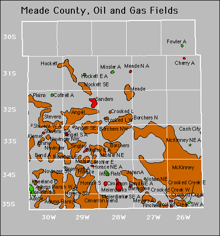

Abandoned
Bond
Bromwell
Cherry
Cottrell
Horace Northeast
Sanders
Stevens West
Gas Storage Fields