| Year | Oil | Gas | ||||
|---|---|---|---|---|---|---|
| Production (bbls) |
Wells | Cumulative (bbls) |
Production (mcf) |
Wells | Cumulative (mcf) |
|
| 1995 | 536,988 | 666 | 58,020,250 | 11,414,164 | 592 | 1,335,289,342 |
| 1996 | 523,279 | 674 | 58,543,529 | 11,834,046 | 652 | 1,347,123,388 |
| 1997 | 503,154 | 655 | 59,046,683 | 11,415,877 | 663 | 1,358,539,265 |
| 1998 | 449,387 | 608 | 59,496,070 | 11,329,113 | 664 | 1,369,868,378 |
| 1999 | 470,148 | 612 | 59,966,218 | 10,969,623 | 681 | 1,380,838,001 |
| 2000 | 473,796 | 631 | 60,440,014 | 11,522,597 | 697 | 1,392,360,598 |
| 2001 | 463,363 | 654 | 60,903,377 | 10,824,095 | 704 | 1,403,184,693 |
| 2002 | 515,919 | 666 | 61,419,296 | 10,334,974 | 734 | 1,413,519,667 |
| 2003 | 476,341 | 766 | 61,895,637 | 9,954,157 | 760 | 1,423,473,824 |
| 2004 | 545,302 | 808 | 62,440,939 | 10,953,913 | 805 | 1,434,427,737 |
| 2005 | 615,047 | 729 | 63,055,986 | 12,287,786 | 893 | 1,446,715,523 |
| 2006 | 763,963 | 800 | 63,819,949 | 13,998,673 | 940 | 1,460,714,196 |
| 2007 | 1,057,501 | 837 | 64,877,450 | 15,360,132 | 1048 | 1,476,074,328 |
| 2008 | 1,397,824 | 936 | 66,275,274 | 17,720,542 | 1142 | 1,493,794,870 |
| 2009 | 1,615,794 | 976 | 67,891,068 | 17,403,951 | 1198 | 1,511,198,821 |
| 2010 | 1,822,698 | 1062 | 69,713,766 | 19,990,859 | 1249 | 1,531,189,680 |
| 2011 | 1,917,025 | 1165 | 71,630,791 | 21,978,264 | 1357 | 1,553,167,944 |
| 2012 | 2,253,941 | 1278 | 73,884,732 | 26,115,592 | 1464 | 1,579,283,536 |
| 2013 | 2,356,338 | 1396 | 76,241,070 | 28,464,432 | 1495 | 1,607,747,968 |
| 2014 | 2,059,343 | 1485 | 78,300,413 | 27,760,982 | 1562 | 1,635,508,950 |
| 2015 | 1,652,323 | 1447 | 79,952,736 | 24,957,992 | 1585 | 1,660,466,942 |
| 2016 | 1,142,514 | 1475 | 81,095,250 | 20,003,053 | 1551 | 1,680,469,995 |
| 2017 | 947,643 | 1480 | 82,042,893 | 17,125,455 | 1480 | 1,697,595,450 |
| 2018 | 793,477 | 1435 | 82,836,370 | 14,911,074 | 1466 | 1,712,506,524 |
| 2019 | 695,874 | 1388 | 83,532,244 | 12,736,510 | 1432 | 1,725,243,034 |
| 2020 | 546,915 | 1304 | 84,079,159 | 10,249,093 | 1363 | 1,735,492,127 |
| 2021 | 611,542 | 1235 | 84,690,701 | 9,978,524 | 1309 | 1,745,470,651 |
| 2022 | 973,669 | 1221 | 85,664,370 | 10,149,683 | 1308 | 1,755,620,334 |
| 2023 | 852,040 | 1166 | 86,516,410 | 9,917,854 | 1255 | 1,765,538,188 |
| 2024 | 754,080 | 1193 | 87,270,490 | 9,203,835 | 1211 | 1,774,742,023 |
| 2025 | 397,394 | 985 | 87,667,884 | 6,538,559 | 1117 | 1,781,280,582 |
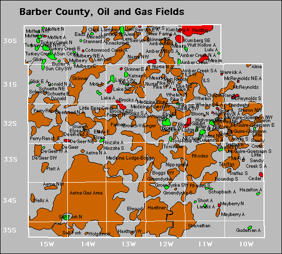

Abandoned
Degeer West
Glick East
Highway North
Highway Northwest
Ketner
Lulu
Mcr
Warwick