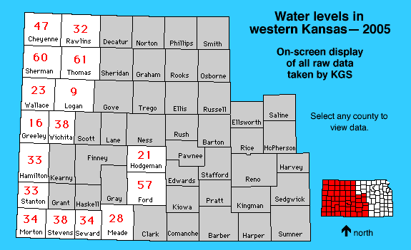
The links below contain data from the 2005 water level survey taken formatted for display on the screen. Select by clicking on the map or using the text links below. The red numbers are the number of wells attempted. Some wells have additional QA or QC readings, and some wells could not be measured. "Provisional" or wells not yet accepted into the official measuring network are marked as "PRV."
This data set contains all well and measurement info for the the January 2005 water level survey where the data was measured by the Kansas Geological Survey. Please also see the Division of Water Resources data set.
Cheyenne || Ford ||
Greeley || Hamilton ||
Hodgeman || Logan
Meade || Morton ||
Rawlins || Seward
Sherman || Stanton
Stevens || Thomas ||
Wallace || Wichita