Kansas Geological Survey, Open-file Report 93-51
KGS Open File Report 93-51
The full report is available as an Adobe Acrobat PDF file (55 kB).
The summer of 1993 brought a regular of large storm systems across the midcontinent states of the US. This combined with the previous summer's high levels of precipitation to saturate soils and increase the rainfall-runoff response. During June relatively high precipitation brought streamflow and river levels up. However, in July, when rainfall usually drops off and temperatures climb, weather systems continued to yield large volumes of precipitation.
This report compiles the real-time bulletins and reports provided by the National Weather Service during July 1993. These reports represent electronic postings that were available through the Kansas State University "UNICORN" information system. Throughout the period of the flooding the author obtained this information via INTERNET and distributed it to interested KGS staff members and public officials. In addition, through the facilities of the US Geological Survey, stream stage plots were available in real-time; with data samples each hour.
This report is composed of this short text and two ASCII data files on diskette. The files contain reports on reservoir conditions and river levels respectively. These are intended to be primary source documentation for the use of future investigators who wish to have a feel for the progression of events that occurred during the flood of July 1993.
As the events of July 1993 transpired, the author was able to access and obtain copies of the National Weather Service reservoir and river forecast bulletins. These were collated and combined with real-time stage measurements from the USGS gauging stations to provide fast turnaround information to local KGS Staff and public officials. Many parallels were drawn with the flood of 1951. That event was within the memory of many Kansas residents and there were a number of interesting parallels. The regional precipitation patterns were all above normal as can be seen in Table 1.
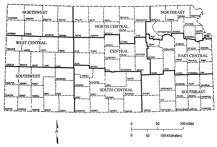
Table 1--1993 and Average Divisional Precipitation. Note: These figures were provided by the Kansas State Weather Library and represent the mean precipitation for all reporting stations in each Division. Figure 1 defines the location of the divisions within Kansas.
| NCDC Division | 1993 Total | % of Normal |
|---|---|---|
| Northwest | 29.53 | 149% |
| North Central | 47.18 | 179% |
| Northeast | 53.45 | 156% |
| West Central | 31.48 | 161% |
| Central | 41.66 | 151% |
| East Central | 48.60 | 137% |
| Southwest | 24.11 | 130% |
| South Central | 34.38 | 131% |
| Southeast | 47.71 | 131% |
Figure 1--Map of Kansas showing reporting areas of the National Weather Service.
This body of information was compiled in an effort to preserve some of the ambiance and to chronicle the nature and volume of information available during the flood. The author found it difficult to find information on the daily events during the flood of 1951. This would be desirable in order to make more realistic comparisons of the development of the flood of 1993. Changes in the river basins of Kansas (primarily the installation of dams and levees) elicited an entirely different hydrologic response. These responses are not described here, but a body of professional and popular literature has been produced on this subject.
Hydrometeorological data on the 1993 flood can be obtained from four primary sources. These are the US Geological Survey (USGS), the National Climatic Data Center (NCDC), the US Department of Agriculture (USDA), and the Kansas State Weather Library. The USGS has District Offices in each state where data on that state are kept. The National Weather Service collects and disseminates their data through the NCDC. Data can be obtained by contacting:
National Climatic Data Center
Federal Building
Asheville, NC 28801
Phone: 704/271-4800
Information available from the USDA can be obtained by contacting:
Climate Analysis Center
Joint Agricultural Weather Facility
USDA South Bldg.
Room 5844
Washington, DC 20250
Phone: 2021720-7919
Kansas weather information can be obtained from the State Climatologist at:
State Climatologist
Weather Data Library
211 Umberger Hall
Kansas State University
Manhattan, KS 66506-3400
Phone: (913) 532-6270
FAX: (913) 532-6487
Electronic mail: mknapp@oz.oznet.ksu.edu
There are two ASCII format files that comprise this Open-file Report. They are the Reservoir Summary in the file, RESINFO.TXT and the River Forecast Statements in RIVINFO.TXT. These files contain the daily or often more frequently released statements from the National Weather Service. They appear as they were downloaded from the network. They are unaltered and may contain a number of spelling or factual errors. Researchers are warned that any hydrologic information provided in these reports were obtained with the best available technology in 1993. Forecasts made by the National Weather Service may have been in error. Many measurements were subject to post-flood correction as many recording devices were damaged in the high waters. Hydrologic information should be corroborated with other sources.
Kansas Geological Survey, Geohydrology
Placed online May 19, 2015; originally released 1993
Comments to webadmin@kgs.ku.edu
The URL for this page is http://www.kgs.ku.edu/Hydro/Publications/1993/OFR93_51/index.html