Kansas Geological Survey, Open-file Report 90-33A
by
Sabine Bock
KGS Open File Report 90-33A
The Ogallala aquifer represents the most imponant water resource for western Kansas. In 1988, 98.3% of the water being withdrawn was used for irrigation; compared to this amount, domestic, municipal, and industrial usages are only of minor importance. Because the irrigated agricultural economy is solely dependent on Ogallala ground water, declining water levels due to advanced irrigation techniques since the 1960's are of serious concern. Basically, the Ogallala aquifer is being mined; with an average annual precipitation of about 460 mm to 580 mm, recharge is estimated to be only 4 mm/year to 14 mmm/year (O'Connor and McClain, 1982). These recharge values are based on actual water level declines and model predictions.
The intent of the presented research was to determine: 1) at what rate is the Ogallala aquifer potentially being recharged; and 2) how important are intermittent streams, playa-like structures and lineaments for contributing recharge to the Ogallala aquifer? For this purpose an attempt was made to date the ground water and the soil water in the unsaturated zone and thus be able to distinguish between older and younger waters. Several different approaches were tried to determine the best suitable dating methods: tritium, the stable isotopes oxygen-IS and deuterium, freon, atrazine, nitrate, and standard inorganic chemistry. In addition, one well was sampled for carbon-14. The combination of the isotopes with the standard inorganic chemistry, especially nitrate clearly worked best for identifying recent recharge.
The project was started in November 1987 and divided into two phases. Phase 1 concerned the establishment of the most suitable analytical method to date the Ogallala ground water, and phase 2 expanded the sampling net and, based on the results of phase 1, concentrated more on the unsaturated zone.
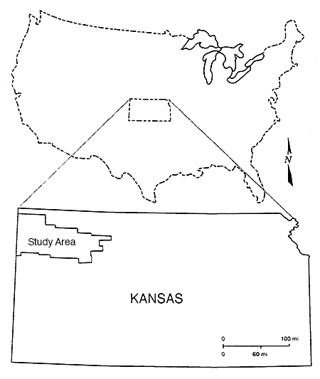
The chosen study area is more or less outlined by Northwest Kansas Groundwater Management District 4 (Fig. 1).
Figure 1--Location of study area
Except for one site, all monitoring well sites are located close to lineaments. which were mapped from satellite imagery (McCauley, 1988). Three of the 11 research sites are located in the vicinity of intermittent streams, and one site is located in a playa-like structure.
A total of 15 wells, eight of which were installed as monitoring wells by the Kansas Geological Survey have been sampled throughout the study. Ground water samples were taken in November 1987 and analyzed for standard inorganic chemistry, tritium, stable isotopes, freon, and atrazine. In August 1989 and November 1989 only samples for standard inorganic analyses were collected. A carbon -14 age determination was performed on one ground water sample.
Soil water from three lysimeters was collected frequently from December 1988 to November 1989 for standard inorganic chemistry analyses, whereas tritium and stable isotope analyses were performed once. One lysimeter was sampled for tritium in three different months, March, June, and November 1989.
At three sites soil cores were taken and tritium content, panicle size, calcium carbonate content, nitrate, atrazine (spot check), moisture, and porosity were determined. However, it was not possible to analyze consistently all the cores taken for these parameters.
A precipitation sample was collected in November 1987 and subsequently analyzed for tritium, stable isotopes, and freon. An additional precipitation samples was collected in October 1989 and analyzed for tritium only.
A stream sample was collected in March 1989 and tritium. stable isotope, and inorganic chemistry analyses were performed.
A tritium input function based on data compiled by the International Atomic Energy Agency was established for the study area to estimate the theoretical tritium input via precipitation over the last 36 years. Thus it became possible to predict the order of magnitude of the tritium concentration left in 1989 after radioactive decay in either the unsaturated or the saturated zone from the emissions in 1961/62 and to compare the theoretical value with actual field data.
The rate of vertical movement of soil moisture through the thick loess cover in the unsaturated zone was determined as well as the amount of precipitation that entered the unsaturated zone as recharge during the period from 1962 to 1989.
A differentiation between older and younger ground water in the Ogallala aquifer was possible and thus potential site specific rates of vertical flow in the unsaturated zone could be determined.
Read the PDF version (5 MB)
Kansas Geological Survey, Geohydrology
Placed online May 8, 2014
Comments to webadmin@kgs.ku.edu
The URL for this page is http://www.kgs.ku.edu/Hydro/Publications/1990/OFR90_33A/index.html