![]()
Prev Page--Triassic (?) System || Next Page--Tertiary and Quaternary Systems
Water-bearing Formations, continued
Cretaceous System
Dakota Group
The Cretaceous rocks found in Morton County are those that overlie the Permian or Triassic (?) redbeds and are correlated with beds that underlie the Graneros shale elsewhere in western Kansas. This series of sandstones, clays, and shales in Kansas and adjacent areas has been described in earlier reports under various classifications.
Cragin (1886, 1889, 1895) classified the Cretaceous sediments of southern Kansas into the Cheyenne sandstone, the Kiowa shale, and the Dakota sandstone, named in ascending order. A little later Gould (1898) made a similar classification, but used the term Medicine beds for strata that lie between the Kiowa shale and the Dakota sandstone. Stose (1912) classified equivalent rocks in eastern Colorado into the Purgatoire formation, containing a lower sandstone member and an upper shale member, and the Dakota sandstone. In 1920, Darton (p. 2) subdivided the Cretaceous rocks that lie below the Graneros shale in western Kansas into the Cheyenne sandstone, the Kiowa shale, and the Dakota sandstone. Twenhofel (1924, pp. 12-30) used the terms Cheyenne sandstone, Belvidere formation, and "Dakota" formation for the Cretaceous sediments of southern Kansas, and retained the term Kiowa for the lower shale member of the Belvidere formation. In describing similar beds in Hamilton county, Kansas, Bass (1926, pp. 59, 73-76) used the term Dakota sandstone for all sediments between the Permian redbeds and the Graneros shale. He recognized, however, that part of these sediments were probably equivalent to the Purgatoire formation of eastern Colorado. Lee (1927, p. 17) correlated the Purgatoire formation and the Dakota sandstone of southeastern Colorado with sediments designated by him as the Dakota group at the Bellvue section in northern Colorado. Elias (1931, p. 28; 1937, p. 10) classified equivalent sediments in western Kansas as the Dakota group. In 1931, Tester (1934, pp. 234-283) applied the name Dakota "stage" to the succession of strata lying between the Graneros shale and Pennsylvanian sediments at the type locality of the Dakota in eastern Nebraska. Saunders (1934, pp. 862-865) divided similar sediments of the Two Buttes area of southeastern Colorado into the Purgatoire formation and the Dakota sandstone. Schoff (1939, pp. 54-57) classified the Cretaceous sediments of western Oklahoma into the Purgatoire formation, including the Cheyenne sandstone and the Kiowa shale members, and the Dakota sandstone.
The term Dakota group has been used by the State Geological Survey of Kansas (Moore and Landes, 1937, Moore, 1940, p. 40) to include all Cretaceous strata that lie below the Graneros shale. At a meeting in Lawrence in January, 1941, the members of the State Geological Survey decided to adopt this usage of the term Dakota group and to use local names for the sandstone forming the upper-most formation of the group and called by some writers the Dakota sandstone. This is the classification used by the Nebraska Geological Survey and by many oil geologists (Kansas Geological Society Guidebook, 1940, pp. 14, 55). In a report on Stanton County, Kansas, Latta (1941, p. 70) states:
Accordingly, under conditions of present knowledge, it seems best to recognize the Dakota group as including the somewhat variable, partly undifferentiated succession of clastic deposits of Cretaceous age below the Graneros shale and to use local names for the subdivisions of the group in those areas where it is possible to subdivide the Dakota group.
All Cretaceous strata in Stanton county belong to the Dakota group. They comprise the Cheyenne sandstone, Kiowa shale, and an upper sandstone (formerly called the Dakota) that is here named the Cockrum sandstone.
Stanton County borders Morton County on the north, and the Cretaceous deposits in both areas are very similar. The classification of Cretaceous sediments used by Latta is followed in the present report for beds of equivalent age in Morton County, and the term Cockrum sandstone is used in this report for the upper sandstone division of the Dakota group.
Cheyenne Sandstone
Character--The Cheyenne sandstone does not crop out in Morton County, but it is known from the records of wells 15 and 17 to underlie the northwestern part of the county (pl. A). Where present, the Cheyenne sandstone generally is encountered at a depth of about 80 to 100 feet below the base of the Cockrum sandstone. It is described by well drillers as a white to gray coarse-grained sandstone. In adjacent areas, in which the formation crops out, it is a white to yellow quartz sandstone of medium to coarse grain and contains subordinate amounts of shale. In some areas the sandstone is conglomeratic near the base.
Distribution and thickness--The Cheyenne sandstone underlies an area of about 50 to 75 square miles in the northwestern part of the county. It was absent in test hole 4, in sec. 36, T. 31 S., R. 42 W., in the artesian well (43) at Richfield, and in test holes 6 and 7, which are farther south. It is encountered in many wells in Stanton county and probably underlies a large part of that county.
The Cheyenne sandstone ranges greatly in thickness. Twenhofel (1924, p. 14) states that--
The bedding is extremely irregular and discontinuous and most beds are merely lenses of limited extent. The writer does not consider it possible definitely to recognize any member beyond the limits of one locality.
The E. M. Watkins well in sec. 11, T. 31 S., R. 43 W., penetrated 125 feet of white sandstone between the Kiowa shale and the Triassic(?) redbeds, which is probably all Cheyenne sandstone, but which may include a part of the Morrison formation. A few miles north of this well the Cheyenne is reported to be 60 feet thick, and 8 miles southeast, it is absent. A test hole on the Hamilton-Stanton county line penetrated 48 feet of the Cheyenne sandstone. The thickness of the Cheyenne is 15 to 50 feet in Cimarron county, Oklahoma; 50 feet at Two Buttes, in southeastern Colorado; 30 to 60 feet in northeastern New Mexico; 15 to 60 feet in Las Animas County, Colorado; and 10 to 55 feet in Kiowa and Commanche counties, Kansas.
Age and correlation--No fossils were obtained from the Cheyenne sandstone in Morton County, so its age can be determined only by correlation with sandstones that crop out in adjacent areas. Its lithology is very similar to that, of the lower part of the Purgatoire formation of Colorado, New Mexico, and Oklahoma and to the Cheyenne sandstone of south-central Kansas. Its stratigraphic position also aids in correlation, for it is found below 50 to 100 feet of dark shale that is correlative with the Kiowa shale and with the shale in thee upper part of thee Purgatoire formation, and it overlies Permian or Triassic (?) redbeds.
Bullard (1928, p. 116) collected marine fossils from the Cheyenne sandstone in Cimarron County, Oklahoma, which he believes are of Washita (Lower Cretaceous) age. Marine pelecypods found by Schoff (1939, p. 55) in the Cheyenne sandstone in the Red Point district in Texas County, Oklahoma, were identified by T. W. Stanton as representing a horizon near the base of the Washita group (Lower Cretaceous).
Origin--The presence of marine pelecypods in the Cheyenne sandstone in Texas county, Oklahoma, is proof of the marine origin of the sandstone in that area, but in Kiowa and Comanche counties, Kansas, the discontinuous bedding, the cross-lamination, the presence of land plants, and the absence of marine fossils seem to indicate a nonmarine origin. It is possible, however, that the Cheyenne in Kansas is also marine, for Twenhofel (1924, pp. 19, 20) states that The vegetable matter appears to have floated in, for nothing has been found suggesting that the vegetation grew where it now occurs.
Water supply--The Cheyenne sandstone yields moderate quantities of water to wells in the northwestern part of the county. The coarse, friable character of the sandstone makes it a good water-bearing bed. In northwestern Morton County the Cheyenne is overlain by the Kiowa shale and that in turn by the Cockrum sandstone (pl. 6C). Wells have been drilled into the Cheyenne sandstone only in those places where the Cockrum does not yield sufficient water for domestic and stock use. In these places the Cheyenne yields adequate quantities of moderately hard water at depths of 175 to 225 feet. The water in the Cheyenne rises in wells to about the same level as the water in the Cockrum. Farther west, near Blaine, in southeastern Colorado, the Cheyenne yields water in flowing artesian wells.
Water from wells in the Cheyenne sandstone is similar to water from the Cockrum sandstone, but is slightly harder and contains more iron than the Cockrum water (see analysis of water from well 15).
Kiowa Shale
Character--Deep wells in the northern part of the county penetrate dark shale below the Cockrum sandstone and above the Cheyenne, Morrison (?), or Triassic (?) beds. It consists of dark-gray or dark-bluish-gray thin-bedded shale containing small amounts of sand and brown clay. Some of the beds are calcareous.
Distribution and thickness--Kiowa shale underlies most of the northern third of the county, is encountered in wells in the north-western and north-central parts of the county, and probably extends eastward beyond the Morton-Stevens county line. Test holes 6, 7, 8, and 11 (fig. 2), failed to encounter the Kiowa shale. Logs of gas test wells in the southeastern part of the county indicate that the formation is also absent in that area.
The thickness of the Kiowa shale is much more nearly uniform than that of the Cheyenne sandstone, and in Morton County ranges from 35 to 85 feet, being greatest in the western part of the county. The Kiowa is 60 feet thick at Two Buttes, Colorado; 70 to 115 feet in Stanton County, Kansas; and reaches a maximum thickness of 150 feet at the type locality in Kiowa County, Kansas.
Age and correlation--No fossils were obtained from the shale in this county, but it seems to correlate clearly with the Kiowa shale on the basis of its lithology and stratigraphic position. The nearest outcrops in adjacent areas are very fossiliferous, and its Comanche (Lower Cretaceous) fauna indicates that it may be equivalent in age to the Glencairn shale member of the Purgatoire formation of Colorado, and to the Fuson shale of Wyoming, Montana and South Dakota.
Water supply--The Kiowa shale is relatively impermeable and yields little or no water to wells in Morton County.
Cockrum Sandstone
Character--The character of the Cockrum sandstone in Morton County is revealed only from two small exposures along a tributary of North Fork of Cimarron River (pl. 7) and from the cuttings of two test holes (4 and 5, fig. 2). The Cockrum sandstone is made up of fine-grained sandstones containing clay and lesser amounts of shale and siltstone. A microscopic study of the well cuttings indicates that about 60 to 65 percent of the Cockrum is made up of sandstone and that the rest is principally clay or shale.
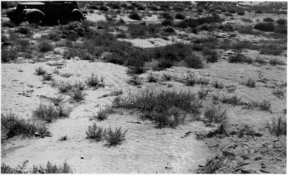
Plate 7--Outcrop of Cockrum sandstone along a tributary of North Fork of Cimarron River (photo by H.T.U. Smith).
The color of the sandstone is principally light buff or brown but may display various shades of red and purple. The distribution of color may be uniform, in irregular splotches, or irregular bands, the color bands being semi-parallel and fairly uniform in width. The banding is due to coloration of the cementing material, not to the color of the sand grains, and there is no change in the character, size, or shape of the sand grains from one colored band to another. About 60 to 65 percent of the sandstone is made up of fine-grained sand and the rest is very fine-grained sand and a small amount of silt. In individual beds the sand grains are very well sorted. The fine sand grains are subangular and subrounded and consist almost entirely of white quartz, but there are a few grains of pink and red quartz. The very fine sand and silt grains are composed mainly of white quartz and are mostly angular to subangular, but a few are subrounded.
The sandstones may be very friable, moderately compact, or quartzitic, depending upon the cementing material and the degree of cementation. The friable and moderately compact material is cemented mainly with iron oxide and the quartzitic material is cemented by pale-gray quartz. The quartzitic material is so tightly cemented that fractures extend through the individual quartz grains.
The clay, which makes up about 35 to 40 percent of the Cockrum sandstone, is principally brown but may be buff, tan, or light greenish gray. The light-greenish-gray material is a thin-bedded, silty clay, but the buff, tan, and brown material contains very little silt.
The bedding in the Cockrum ranges from thin laminae of silty clay to massive ledges of quartzitic sandstone. One test hole penetrated 62 feet of sandstone containing very few if any partings of clay or shale. Some of the thin-bedded sandstones in the Cockrum are ripple-marked.
Distribution and thickness--The Cockrum sandstone crops out along a tributary of North Fork of Cimarron River in the northern tier of townships. Along most of the stream's course the sandstone is covered by a few feet of alluvium, but it is exposed in small areas in sec. 33, T. 31 S., R. 41 W., and in sec. 21, T. 31 S., R. 43 W. The Cockrum underlies the northern two tiers of townships in Morton County, and in the western half of the county the formation may extend as much as 1 mile south into the third tier of townships. Test holes drilled in the southwestern quarter of the county failed to encounter the Cockrum sandstone, and logs of gas test wells in the southeastern part of the county indicate that the formation is also absent there. Part of the rocks at Point Rock previously mapped as the Cockrum sandstone are now believed to be Triassic (?) in age. The rocks bear no resemblance to the Cockrum sandstone, and the Cockrum was not encountered in nearby test hole 6 (fig. 2) and in gas test wells.
Only a small part of the Cockrum sandstone is exposed in the county, so the thickness is known only from test holes and from drillers logs. Only two test holes (4, 5) in Morton County were drilled through the Cockrum sandstone. In test hole 4, which is 3 miles northwest of Richfield, the Cockrum was found to be only 37 feet thick and in test hole 5, which is 6.5 miles east-northeast of Richfield, it was 150 feet thick. Drillers' logs indicate 130 feet of Cockrum sandstone at Richfield and 75 feet in the northwestern corner of the county.
Origin--The Cockrum sandstone contains both marine and non-marine fossils, so its origin is problematical. It has been suggested by Moore (1933, p. 443) that the Cockrum is a stream-laid and sea-worked deposit.
Age and correlation--For a discussion of the age and correlation of the Cockrum sandstone, see pages 73 and 74.
Water-supply--The Cockrum sandstone ranks second in importance to the Ogallala formation as a source of ground water in this county. It supplies many wells in the northwestern part of the county in T's. 31 and 32 S., R's. 41, 42, and 43 W. The Cockrum generally is well sorted and moderately permeable, but locally, however, it. is relatively impermeable, owing presumably to cementation by quartz, and yields little or no water to wells. In the north-eastern quarter of T. 31 S., R. 42 W., the Cockrum contains little or no water, and wells are drilled to the Cheyenne sandstone in order to get a sufficient supply for domestic and stock use. The yields of wells in the Cockrum range from 1 gallon a minute from some windmill wells to 200 gallons a minute from the irrigation well on the Lloyd Ball farm (p. 54). In about one-third of the Cockrum wells the depth to water level is less than 50 feet, and in about two-thirds of the wells it is between 50 and 100 feet, but in a few wells it is 100 to 120 feet.
In general the water from the Cockrum is relatively hard. It is harder than the average water from the Ogallala, but is softer than the water from the Cheyenne sandstone. Most of the water from the Cockrum sandstone contains 2 to 4 parts per million of fluoride and hence is likely to mottle the enamel of children's teeth.
Prev Page--Triassic (?) System || Next Page--Tertiary and Quaternary Systems
Kansas Geological Survey, Morton County Geohydrology
Comments to webadmin@kgs.ku.edu
Web version Sept. 2004. Original publication date March 1942.
URL=http://www.kgs.ku.edu/General/Geology/Morton/07_form3.html