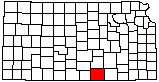
Sumner County
|
|
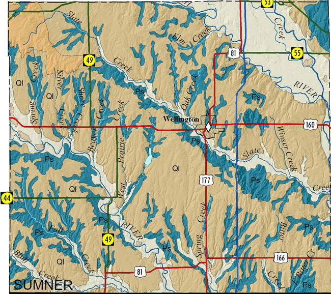
Sumner County |
|
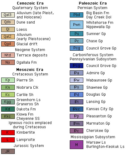
Because no detailed digital mapping has been done for this county, this map is extracted from the state geologic map.
|
|
Walters, K.L., 1961, Geology and ground-water resources of Sumner County, Kansas: Kansas Geological Survey, Bulletin 151, 198 p. (out of print, available online)
As part of U.S. Geological National Cooperative Geologic Mapping Program (STATEMAP), the KGS has produced 7 1/2 minute quadrangle maps as part of the Sumner County geologic mapping project.
Layzell, A.L., and Dunham, J.W., 2018, Preliminary surficial geology of the South Haven quadrangle, Sumner County, Kansas: Kansas Geological Survey, Open-file Report 2018-6, 1 sheet, scale 1:24,000, unpublished [PDF available online]
Layzell, A.L., and Dunham, J.W., 2018, Preliminary surficial geology of the Adamsville quadrangle, Sumner and Cowley counties, Kansas: Kansas Geological Survey, Open-file Report 2018-8, 1 sheet, scale 1:24,000, unpublished [PDF available online]
Layzell, A.L., and Dunham, J.W., 2018, Preliminary surficial geology of the Oxford quadrangle, Sumner and Cowley counties, Kansas: Kansas Geological Survey, Open-file Report 2018-9, 1 sheet, scale 1:24,000, unpublished [PDF available online]
Smith, J.J., and Dunham, J.W., 2018, Preliminary surficial geology of the Bluff City East quadrangle, Harper and Sumner counties, Kansas: Kansas Geological Survey, Open-file Report 2018-12, 1 sheet, scale 1:24,000, unpublished [PDF available online]
Layzell, A.L., and Dunham, J.W., 2019, Preliminary surficial geology of the Caldwell quadrangle, Sumner County, Kansas: Kansas Geological Survey, Open-file Report 2019-8, 1 sheet, scale 1:24,000, unpublished [PDF available online]
Layzell, A.L., and Dunham, J.W., 2019, Preliminary surficial geology of the Caldwell NW quadrangle, Sumner County, Kansas: Kansas Geological Survey, Open-file Report 2019-9, 1 sheet, scale 1:24,000, unpublished [PDF available online]
Layzell, A.L., and Dunham, J.W., 2019, Preliminary surficial geology of the Perth quadrangle, Sumner County, Kansas: Kansas Geological Survey, Open-file Report 2019-10, 1 sheet, scale 1:24,000, unpublished [PDF available online]
Smith, J.J., and Dunham, J.W., 2019, Preliminary surficial geology of the Argonia quadrangle, Harper and Sumner counties, Kansas: Kansas Geological Survey, Open-file Report 2019-13, 1 sheet, scale 1:24,000, unpublished [PDF available online]
Smith, J.J., and Dunham, J.W., 2019, Preliminary surficial geology of the Freeport quadrangle, Harper and Sumner counties, Kansas: Kansas Geological Survey, Open-file Report 2019-14, 1 sheet, scale 1:24,000, unpublished [PDF available online]
Cartographic Services, Kansas Geological Survey
Updated December 9, 2020
Comments to webadmin@kgs.ku.edu
URL=http://www.kgs.ku.edu/General/Geology/County/rs/sumner.html