Shawnee County
|
|
Shawnee County |
|
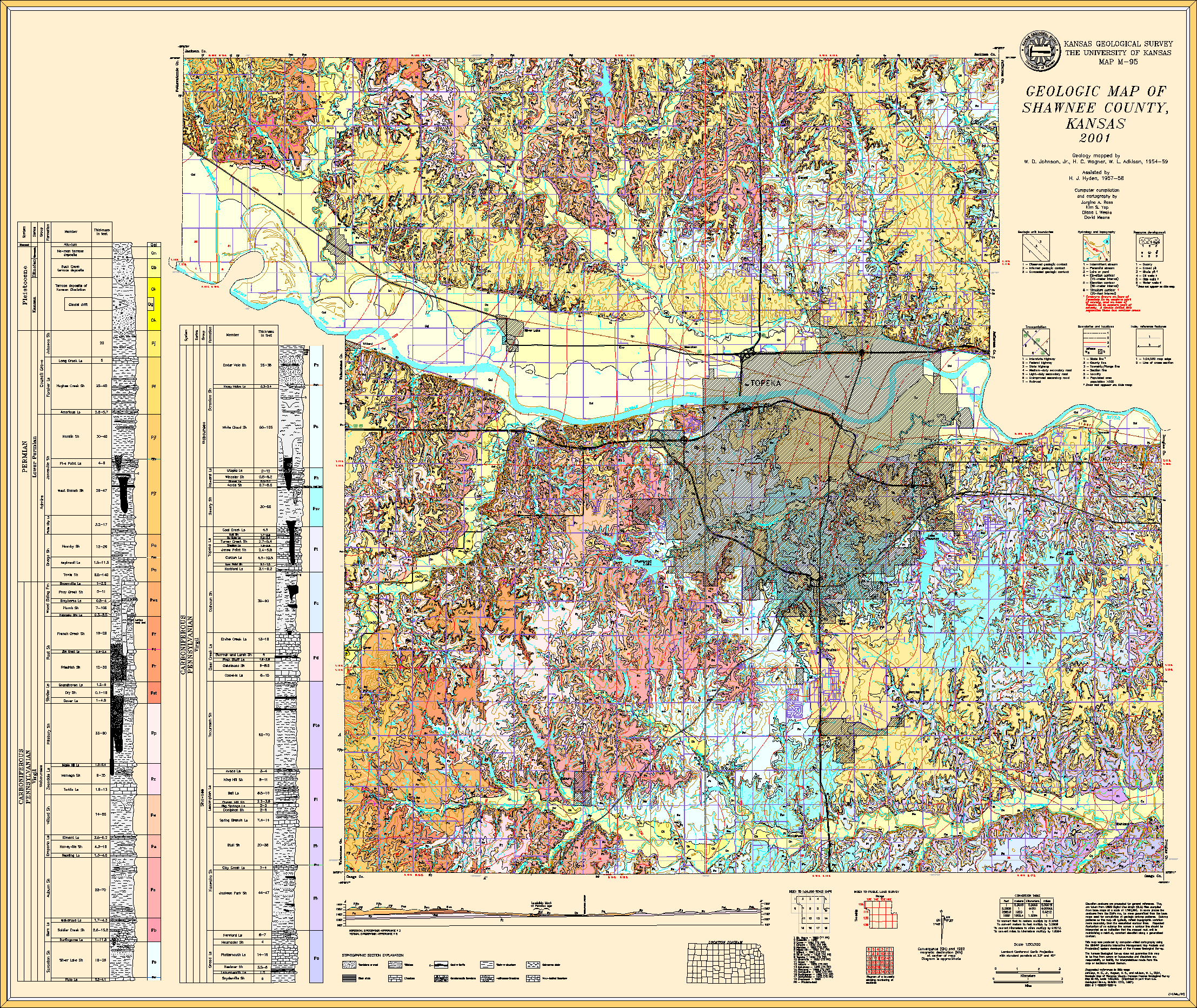
Johnson, W.D., Jr., Wagner, H.C., and Adkison, W.L, 2001, Geologic map of Shawnee County, Kansas: Kansas Geological Survey, Map M-95, scale 1:50,000, 44 x 37 inches
Paper copies of the complete map (with stratigraphic column and legend info) can be purchased from the Kansas Geological Survey, 1930 Constant Ave., Lawrence, KS 66047 (or phone 785-864-3965) and at 4150 W. Monroe St., Wichita, KS 67209-2640 (phone 316-943-2343).
Johnson, W.D., Jr., and Adkison, W.L., 1967, Geology of Eastern Shawnee County, Kansas, and Vicinity: U.S. Geological Survey, Bulletin, no. 1215-A, pp. 1-124 [available online]
Johnson, W.D., Jr., and Wagner, H.C., 1967, Geology of Eastern Shawnee County, Kansas, and Vicinity: U.S. Geological Survey, Bulletin, no. 1215-B, pp. 125-254 [available online]