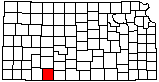
KGS Home

Geology Index Page

Clark County

Geologic Maps of Kansas

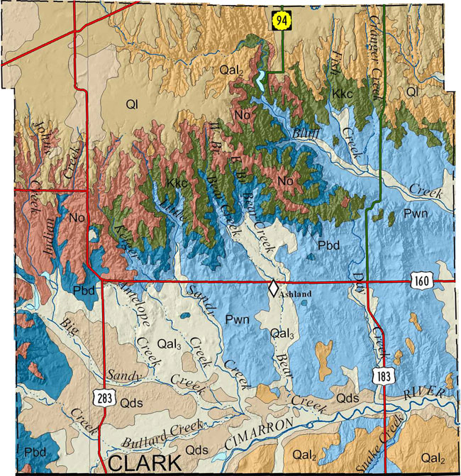
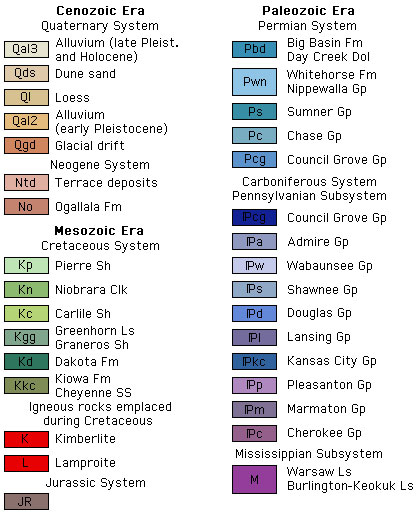
Because no detailed digital mapping has been done for this county, this map is extracted from the state geologic map.

clark county geologic map

Publication Info

Fairer, G.M., and Green, M.W., 1993, Preliminary geologic map of the Bloom SW quadrangle and parts of the Bloom, Minneola, and Fowler SE quadrangles, Clark County, Kansas: U. S. Geological Survey, Open-file Rept. 92-0698, 5 p., 1 sheet, scale 1:24,000

Fairer, G.M., and Green, M.W., 1994, Preliminary geologic map of the Ashland NW quadrangle and parts of the Englewood, Profitt Lake, and Mount Helen quadrangles, Clark County, Kansas: U. S. Geological Survey, Open-file Rept. 92-0655, 1 sheet, scale 1:24,000

Fairer, G.M., and Green, M.W., 1994, Preliminary geologic map of the Ashland quadrangle and part of the Ashland SE quadrangle, Clark County, Kansas: U. S. Geological Survey, Open-file Rept. 92-0657, 1 sheet, scale 1:24,000

Green, M.W., and Fairer, G.M., 1993, Preliminary geologic map of the Bloom SE quadrangle and part of the Simmons Creek quadrangle, Clark County, Kansas: U. S. Geological Survey, Open-file Rept. 92-0697, 5 p., 1 sheet, scale 1:24,000

Green, M.W., and Fairer, G.M., 1994, Preliminary geologic map of the Mount Jesus quadrangle and parts of the Mount Jesus NW, Lexington, and Turkey Creek quadrangles, Clark County, Kansas: U. S. Geological Survey, Open-file Rept. 92-0656, 8 p., 1 sheet, scale 1:24,000

Green, M.W., and Fairer, G.M., 1994, Preliminary geologic map of the Sitka quadrangle and parts of the Sitka SW, Sugarloaf, and Trout Creek quadrangles, Clark County, Kansas: U. S. Geological Survey, Open-file Rept. 92-0658, 8 p., 1 sheet, scale 1:24,000

GIS Data

The Kansas Data Access and Support Center (DASC) has ArcInfo coverages available for this generalized geologic data.


Automated Cartography Unit, Kansas Geological Survey
Updated October 2000
Comments to webadmin@kgs.ku.edu
URL=http://www.kgs.ku.edu/General/Geology/County/abc/clark.html