Kansas Geological Survey, Current Research in Earth Sciences, Bulletin 250, part 1
Back to Petroleum Potential...
![]()
![]()
![]()
Kansas Geological Survey, Current Research in Earth Sciences, Bulletin 250, part 1
Back to Petroleum Potential...
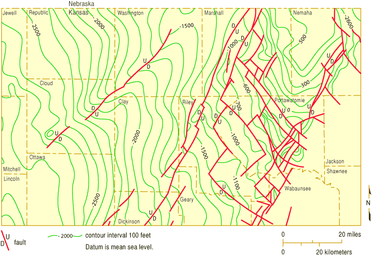
![]()
Figure 18--Map showing detailed faulting in extreme northeastern Kansas subsurface, including relative directions of motion that can be measured and interpreted from subsurface data. Direction of dip of fault planes is not indicated. From Berendsen (1999).
Back to Petroleum Potential...
Kansas Geological Survey, Current Research
Web version Sept. 15, 2004
http://www.kgs.ku.edu/Current/2004/Gerhard/fig18.html
email:webadmin@kgs.ku.edu