Kansas Geological Survey, Subsurface Geology 6, p. 1-7
by
Wendy Autio
University of Kansas
An Acrobat PDF file containing the complete paper is available (424 kB).
The principal objectives of this study are to interpret the depositional environments and facies relationships of the Simpson Group in the subsurface of Rice, Reno, and McPherson counties, Kansas (fig. 1 and table 1). Simpson deposition may have been affected by structures that formed during the Middle Ordovician, especially a large, northwest-trending positive feature, including the Chautauqua arch, an unnamed hinge area, and the ancient Central Kansas uplift. This positive feature separated the North Kansas Basin from a basin that extended into Oklahoma. This study is concerned with the hinge area and how it affected the deposition of the Simpson Group. Recently discovered magnetic anomalies show evidence of basement lineaments within the study area (Yarger, 1981). Recurrent basement movement along these lineaments may have affected the depositional facies of the Simpson Group.
Figure 1--Map of Kansas showing study area and location of cores.
Table 1--List of wells shown in fig. 1. Abbreviations in parentheses following well name are code used to label core and thin sections.
| Name | Location | Depth of cored interval |
|---|---|---|
| 1. N.C.R.A. 11 W 9 S Schroeder | NW NE NW 11, 18 S, 9 W | 3262-3283 |
| 2. Champlin 1 Kottman | C NE SW 19, 19 S, 8 W | 3365-3398 |
| 3. Northern Natural Gas 1 Madsen | NE NE 35, 19 S, 8 W | 3241-3278 |
| 4. Northern Natural Gas 35-9 Pulliam | NW SW NE 35, 19 S, 8 W | 3258-3290 |
| 5. Shell 1 H. Soeken | C W2 10, 19 S, 9 W | 3239-3252 |
| 6. Shell 1 W. H. Welsh | C SW NW 1, 20 S, 8 W | 3392-3407 |
| 7. Northern Natural Gas 1 Caldwell | NE NE 2, 20 S, 8 W | 3301-3348 |
| 8. Champlin 8 Speck | C NW NW 18, 20 S, 8 W | 3412-3451 |
| 9. J.A. Allison B-1 Collins | NW NE NW 16, 24 S, 4 W | 3755-3789 |
| 10. Midcontinent Marine 1 Hilger | SW C NW 34, 25 S, 4 W | 4140-4153 |
| 11. Shell 1 A.C. Gordon | C WL NE 21, 21 S, 10 W | 3386-3443 |
| 12. Midcontinent Marine 1 S. Hilger | W2 SW SW 9, 26 S, 4 W | 4042-4050 |
| 13. Shell 4 P.A. Koehn | SW NE NE 16, 21 S, 3 W | 3394-3412 |
| 14. Shell L. Lawrence | SW NE NW 35, 19 S, 3 W | 3500-3530 |
| 15. Derby 1 Rainbow | NW NW SE 33, 22 S, 7 W | 3874-3935 |
In Kansas, the Middle Ordovician Simpson Group is found only in the subsurface. It reaches a maximum thickness of 77 m (254 ft) in the Sedgwick Basin. The Simpson unconformably overlies the Arbuckle Group (Early Ordovician) and underlies the Viola Limestone (Middle Ordovician). The Middle Ordovician of Kansas is equivalent to parts of thicker sections in Oklahoma. The Simpson Group consists of white to light-gray quartzose sandstones interbedded with greenish-gray shales, limestones, and dolomites. According to Dapples (1955), the Simpson Group represents a transgressive shoreline deposit that spread into Kansas from a basin centered in Oklahoma. The Simpson probably was deposited throughout eastern and central Kansas, but later erosion removed it from the Chautauqua arch, the Central Kansas uplift, and the northern part of the Nemaha anticline (Goebel, 1968).
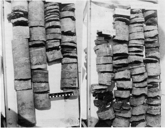
Figure 2--Northern Natural Gas No. 1 Caldwell core, 3,300-3,325 ft.
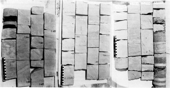
Figure 3--Northern Natural Gas No. 1 Caldwell core, 3,325-3,348 ft.
Eight lithofacies are recognized in the Simpson Group of central Kansas, based on lithology and sedimentary structures. Some of the lithofacies always are found in the same place in each section, but several lithofacies occur in different positions in the section and may even be repeated.
Lithofacies 1--consists of laminated dark-greenish-gray to greenish-black mudshale containing abundant inarticulate and articulate brachiopod shells and shell fragments. The mudshale is thin to medium laminated with laminations from .5 to 3 mm in thickness. Intraclasts are common, and secondary pyrite is abundant. This lithofacies commonly occurs near the base of the Simpson Group, but it also can be found higher up in the section. It is often overlain by bioturbated greenish-gray sandy mudstone (lithofacies 4). Planar lamination is interpreted as representing settling from suspension without traction, based on the fine grain size of the material. Lithofacies 1 makes up 24% of the thickness of all the sections.
Lithofacies 2--consists of nonlaminated greenish-gray calcareous mudstone with no observed fossils. This lithofacies is not very abundant as it makes up only 1.3% of the thickness of all the sections. Lithofacies 2 overlies a fine quartz sandstone (lithofacies 6) and underlies a sandy shale (lithofacies 4).
Lithofacies 3--consists of structureless greenish-gray siltstone with evidence of bioturbation. Burrowing is primarily horizontal and gives the siltstone a mottled appearance. The burrows are 1-2 mm in diameter. Lithofacies 3 commonly overlies a burrowed greenish-gray sandy mudstone (lithofacies 4). In places it is overlain by a fine-grained quartz arenite (lithofacies 6) and may be part of a coarsening-upwards sequence. Lithofacies 3 makes up 2.3% of the thickness of all the sections.
Lithofacies 4--is composed of bioturbated greenish-gray, dark-greenish -gray, and olive-black mudstone containing white to tan, very fine grained quartz sand filling the burrows. No structure is observed in the mudstone. Burrows primarily are horizontal, with some short vertical burrows, and are probably of the ichnogenus Planolites. The grain size and abundance of the sand often increase upwards. This lithofacies commonly overlies the laminated mudshale (lithofacies 1), but it can be found throughout the section. Lithofacies 4 is the most abundant of all the lithofacies, constituting 41% of the thickness of all the sections.
Lithofacies 5--consists of thin laminations of alternating olive-black mudshale and white very fine grained quartz sand. The laminations are .5-1 mm in thickness. This lithofacies overlies a mudshale (lithofacies 1) and underlies a sandy unit (lithofacies 6). Lithofacies 5 makes up only .2% of the thickness of all the sections.
Lithofacies 6--consists of structureless very fine to coarse, nearly pure quartz arenite with intraclasts. Greenish-gray shale partings are common.
Lithofacies 7--consists of plane-laminated, ripple-laminated, and cross-stratified very fine to coarse-grained quartz arenite with intraclasts and shale partings. Lithofacies 6 and 7 are very similar, but x-radiographs of lithofacies 6 show that bioturbation has destroyed any sedimentary structures that may have been present. Plane laminations in lithofacies 7 are 1 mm in thickness. Cross-stratification of lithofacies 7 is medium scale, and laminae dip a maximum angle of 25° from horizontal. These lithofacies usually are found in the middle or near the top of the section and commonly overlie the bioturbated sandy mudstones of lithofacies 4. The sedimentary structures indicate this unit was deposited by migration of dunes or sand waves in the upper part of the lower flow regime (Harms, 1982). Lithofacies 6 and 7 make up 27.5% of the total thickness of all the sections.
Lithofacies 8--consists of red and green mottled silty dolomite and limestone. This lithofacies usually is found near the top of the section and often caps the section. Lithofacies 8 makes up 3.7% of the measured sections.
Figure 4--Gamma ray and neutron logs of Northern Natural Gas No. 1 Caldwell, Simpson Group interval.
Six of the Simpson facies can be recognized in the Northern Natural Gas 1 Caldwell core. The base of the core contains a dark-greenish-gray mudshale of lithofacies 1 and suggests deposition in a shelf or lagoonal environment, based on the fine grain size, fine laminations, and the predominance of Lingula brachiopods. The mudshale is overlain by a bioturbated mudstone and very fine sandstone that indicates deposition in a lower shoreface zone, transition zone, or washover sediment into a lagoon. The high level of bioturbation suggests low wave energy and relatively slow sedimentation rates, so the sediment emplaced during storms was reworked (Elliot, 1978). This bioturbated layer is overlain by a bioturbated greenish-gray siltstone of lithofacies 3. The siltstone could have been deposited on a shelf or in a lagoon. The siltstone of lithofacies 3 is overlain by a structureless very fine to medium-grained quartz arenite of lithofacies 6. Higher in the section one crossbed is observed in this core. The quartz arenite may represent a middle shoreface and upper shoreface environment. The core is capped by a recrystallized silty dolomite of lithofacies 8.
The sequence observed in the Northern Natural Gas 1 Caldwell core is a gradational coarsening-upward sequence, with sand increasing in both abundance and grain size upwards. This sequence could have been formed in several different environments. The coarsening-upwards sequence may represent progradation of shoreline deposits over shelf deposits. The sequence also could have formed as a barrier island transgressed over a lagoon, similar to a model proposed by Kraft and John (1979). In this model, the overwash process is the dominant mechanism. Esslinger (1983) suggests that the Simpson Group of Oklahoma was deposited in a progradational estuarine environment. He suggests that the lack of land vegetation in the Ordovician would allow less-confined, coalescing estuaries. Detailed well-log analysis of the area should delineate the size and shapes of the sand bodies of the Simpson Group and aid in pinning down the depositional environment, as well as help in any future oil and gas exploration within the Simpson Group.
Figure 5--Graphic core description for Northern Natural Gas No. 1 Caldwell well (NE NE sec. 2, T. 20 S,, R. 8 W., Rice County, Kansas.
Dapples, E. C., 1955, General lithofacies relationship of the St. Peter Sandstone and Simpson Group: American Association of Petroleum Geologists, Bulletin, v. 30, p. 444-467.
Elliot, T., 1978, Clastic shorelines; in, Sedimentary Environments, H. G. Reading, ed.: New York, Elsevier, p. 143-177.
Esslinger, B., 1983, Facies and depositional environment of the Simpson Group (Middle Ordovician) of central Oklahoma: M.S. thesis, University of Missouri (Columbia), 72 p.
Goebel, E. D., 1968, Ordovician System; in, The Stratigraphic Succession in Kansas, D. E. Zeller, ed.: Kansas Geological Survey, Bulletin 189, 81 p.
Harms, J. C., and others, 1982, Structures and sequences in clastic rocks: Society of Economic Paleontologists and Mineralogists, Short Course No. 9, 249 p.
Kraft, J. C., and John, C. J., 1979, Lateral and vertical facies relations of transgressive barriers: American Association of Petroleum Geologists, Bulletin, v. 64, p. 2,145-2,164.
Yarger, H. L., 1981, Aeromagnetic survey of Kansas: EOS, v. 62, no. 17, p. 173-178.
Kansas Geological Survey
Comments to webadmin@kgs.ku.edu
Web version April 12, 2010. Original publication date 1985.
URL=http://www.kgs.ku.edu/Publications/Bulletins/Sub6/Autio/index.html