![]()
Prev Page--Contents || Next Page--Water-bearing Materials
Introduction
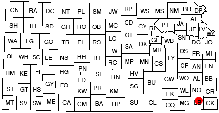
The area described in this report includes about 10 square miles bordering Neosho river in northeastern Labette County, Kansas (fig. 1), adjacent to the Kansas Ordnance Plant reservation.
Fig. 1--Map of Kansas showing study area of this report.
On January 13, 1942, Mr. L. C. Childs, of the firm of Consoer, Townsend, and Quinlan, and Battey and Childs, architect-engineers for the Kansas Ordnance Plant, requested the cooperation of the Federal Geological Survey and the State Geological Survey of Kansas in making test borings at proposed dam sites and in prospecting for a possible source of water supply in the Neosho river valley in the vicinity of the Kansas Ordnance Plant, near Parsons, Kansas. In view of the importance of this project for the prosecution of the war, the investigation was undertaken immediately under the direction of S. W. Lohman, Federal geologist in charge of ground-water investigations in Kansas, and Raymond C. Moore, state geologist and director of the State Geological Survey. The firm of architect-engineers furnished subsistence to members of the drilling crew and supplied men to assist with the routine labor necessary to the investigation. The Kansas State Board of Health made the analyses of the water samples collected. The results of the analyses are included in this report through the courtesy of the State Board of Health and the architect-engineers.
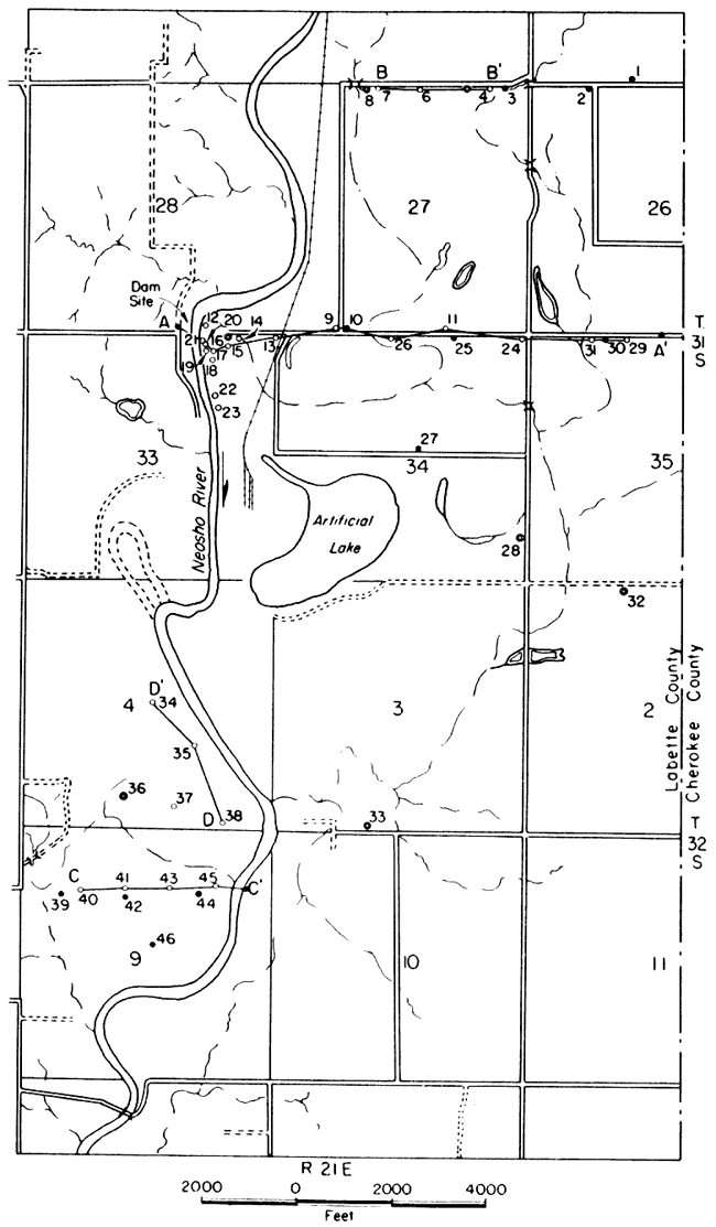
The field work was done mainly during the period from January 15 to February 9, 1942. Using the portable hydraulic-rotary drilling machine owned by the State and Federal Geological Surveys, Ellis D. Gordon, driller, James B. Cooper, sampler, and LeRoy Fugitt, assistant driller, drilled and cored 8 test holes to determine subsurface conditions at proposed dam sites along Neosho river and drilled 21 test holes in the alluvium of the Neosho river valley. During October, 1942, 18 holes were bored in the alluvium by hand auger to obtain additional data for construction of a water-table contour map. Levels were run to the auger holes and to the water surface of several creeks and ponds by Silas C. Brown and Richard Tripp, of the State Geological Survey of Kansas. Levels were run to the test holes by the architect-engineers. The locations of the test holes and auger holes are shown in figure 2. Four wells were selected in June, 1943, for periodic measurement, and these measurements will be continued for an indefinite length of time.
Fig. 2--Map of a part of Neosho river valley showing locations of test holes, auger holes, and wells. Open circles designates rotary test hole, closed circle designates hand auger hole, and double circle designates a well.
The pumping test described herein was conducted by the Layne-Western Company for the Kansas Ordnance Plant, and the results of the test and elevations of the pumped well and observation wells were supplied by John A. Fulkman, of the architect-engineers. V. C. Fishel, physicist for the Federal Geological Survey, assisted in interpreting the pumping test data for field determinations of permeability and offered many valuable suggestions which have been incorporated in this report. John C. Frye and G. E. Abernathy of the Kansas Geological Survey assisted in a reconnaissance of the valley. S. W. Lohman visited the area of investigation several times and assisted in planning the field work and the form of the report.
This report was reviewed critically by O. E. Meinzer, S. W. Lohman, L. K. Wenzel, V. C. Fishel, and W. D. Collins of the Federal Geological Survey; John C. Frye, assistant director, State Geological Survey of Kansas; George S. Knapp, chief engineer, Division of Water Resources, Kansas State Board of Agriculture; and Ogden S. Jones, geologist, Division of Sanitation, Kansas State Board of Health.
Geology in Relation to Ground Water
Pennsylvanian Rocks
The bedrock underlying the part of the Neosho river valley studied consists of the upper part of the Cherokee shale and the Fort Scott limestone. The Fort Scott limestone forms the escarpments bordering the Neosho valley in this area.
The base of the Fort Scott limestone (which is also the top of the Cherokee shale) is placed by definition at the base of the lower of two limestones at the type locality of the Fort Scott (Moore, 1936, p. 58). Beds of sandstone and sandy limestone (pl. 1A) encountered in test hole 17 and certain other test holes are in the uppermost part of the Cherokee shale and may be equivalent to the Breezy Hill limestone member (Pierce and Courtier, 1937, p. 33). The Fort Scott-Cherokee formational contact is shown in figure 3. A few domestic wells have been dug to the base of the Fort Scott limestone and are reported to yield small quantities of water in seasons of normal precipitation. Water is obtainable in small quantities in seasons of normal precipitation from the porous soil cover above the Cherokee shale (Moore, 1940, p. 50). The unweathered part of the Cherokee shale has very low permeability and yields little or no water to wells. The beds of sandstone that were encountered in test holes in this area are very fine grained and tightly cemented; hence they probably would yield little or no water to wells.
Plate 1A--Outcrop of sandstone in the upper Cherokee shale, SW NW sec. 33, T. 31 S., R. 21 E.
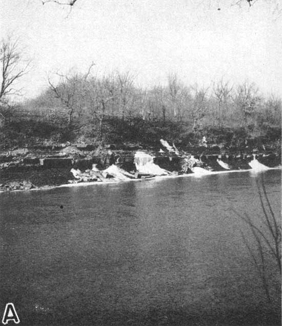
Fig 3--Outcrop of sandstone in the upper Cherokee shale, SW NW sec. 33, T. 31 S., R. 21 E. A laregr version of this figure is available as an Acrobat PDF file.
Quaternary Deposits
Terrace Deposits
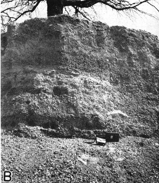
Terrace deposits of clay, sand, and gravel occur in patches along a belt about 2.5 miles wide just west of Neosho river, from about 840 to 850 feet above sea level, or about 30 feet above normal river level. Such deposits have been removed from much of the west side of the valley and cannot be found on the east side in this part of the valley. Where present, the terrace gravels range in thickness from a few inches to about 20 feet. The pebbles making up the gravel are composed mostly of brown subangular chert. The gravel and associated sand and clay are exploited for road material at a pit in the SE NW sec. 17, T. 31 S., R. 21 E. The thickness of the material at the gravel pit is about 20 feet (pl. 1B.)
Plate 1B--Terrace gravel deposit, SE NW sec.17, T. 31 S., R. 21 E.
According to Pierce and Courtier (1937, p. 51)
The Quaternary [terrace] gravels in Labette County contain brown chert, which, in conjunction with their regional location, suggests that they were derived from the chert in the limestones of Pennsylvanian age which now lie to the northwest.
The present investigation resulted in no additional evidence bearing on the age of the terrace deposits. Therefore, Pierce and Courtier's conclusion that these deposits are of Quaternary age is accepted for this report.
The bedding and sorting of the deposits, together with the degree of rounding of the pebbles, indicate fluviatile deposition. The pebbles in the terrace gravels are very similar to those in the alluvium which indicates that they were a source of part of the alluvium. The terrace gravels were deposited before the river had excavated its present valley, and, when mapped in detail over a large area, drainage lines of an ancestral Neosho river probably will be revealed.
The terrace deposits are not a source of ground water in this area because they are discontinuous and limited in extent, and owing to their high topographic position any water that seeps into them drains out rapidly.
Alluvium
General considerations--The alluvium of the Neosho river valley yields water to many domestic and stock wells in the valley, but very little was known concerning the quality and quantity of water available for industrial or municipal use. In order to determine the thickness, character, and extent of the alluvium, the locations of any deep channels that might have been excavated into bedrock, and the quality of the water, 21 test holes (in addition to the 8 drilled at dam sites) were drilled at the locations indicated in figure 2.
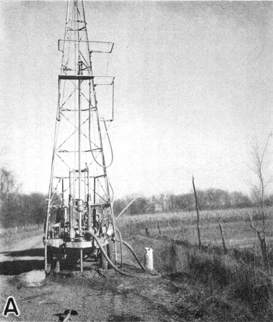
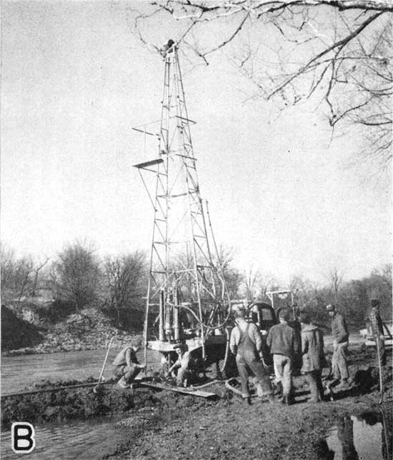
The test holes were drilled through the alluvium and from 6 inches to 37 feet into bedrock by the hydraulic-rotary method (pl. 3). Samples of the material drilled were collected at regular intervals or whenever any change in the character of the alluvium was noted, and these samples were studied microscopically in the laboratory. After the completion of each test hole that encountered water-bearing gravel, a sample of water was obtained in the following manner. A 5-foot screened well point was attached to the drill stem and lowered nearly to the bottom of the hole. Water was pumped using the mud pump on the well rig for a period of time sufficient to obtain a reasonably clear sample of water for analysis (pl. 3A).
Plate 3--A, Pumping water from test hole 6 with the drilling rig. B, Core drilling at a prospective dam site at Neosho river's edge.
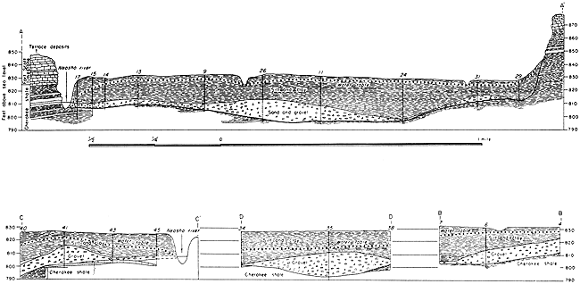
Character of material--The alluvium in the Neosho river valley consists of silt, clay, sand, and gravel. In general it is about 35 feet thick. The upper 10 to 30 feet is composed generally of silt and clay in varying proportions and locally contains some very fine sand. In most places this material contains flakes and concretions of limonite. Poorly sorted sand and gravel, ranging in thickness from a few inches to 15 feet, generally underlies the silt and clay. Some of the gravel closely resembles the terrace gravel described above and is probably derived in part from terrace deposits. The sand and gravel in the alluvium ranges greatly in thickness, as shown in plate 2 and as indicated in the logs given at the end of this report.
Water supply--The gravel in the alluvium supplies sufficient water for domestic and stock use in most parts of the Neosho valley. Most of these supplies are obtained from driven wells that generally are about 10 to 20 feet deep. These wells are reported not to have failed during the droughts that occurred between 1930 and 1940. As indicated elsewhere in this report, yields of about 50 gallons a minute may be expected from properly constructed wells in areas of the valley where the alluvium contains beds of saturated gravel that are 5 or more feet thick.
Prev Page--Contents || Next Page--Water-bearing Materials
Kansas Geological Survey, Geology
Placed on web Aug. 11, 2008; originally published March 1944.
Comments to webadmin@kgs.ku.edu
The URL for this page is http://www.kgs.ku.edu/Publications/Bulletins/52_2/02_intro.html