![]()
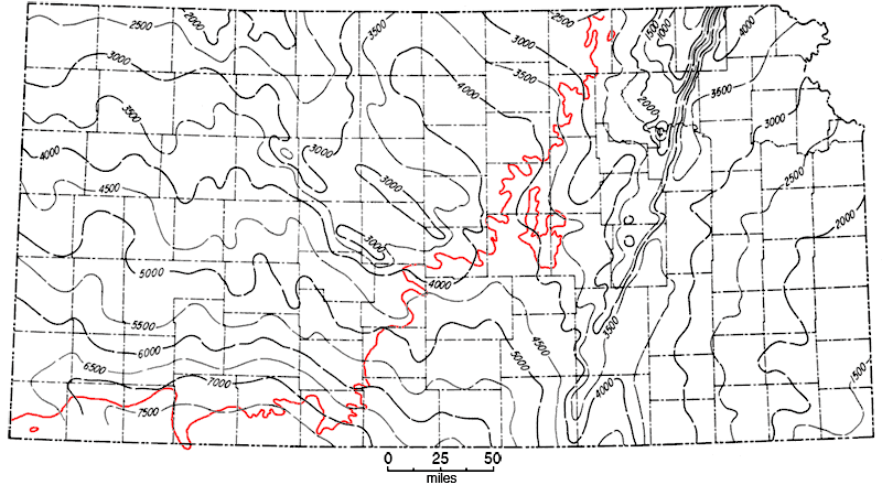
Figure 31
Figure 31--Map showing thickness of Paleozoic rocks in Kansas. Area northwest of [red] line is buried beneath Mesozoic deposits. Contour interval 500 feet.
Kansas Geological Survey, Geologic History of Kansas
Comments to webadmin@kgs.ku.edu
Web version April 2006. Original publication date Dec. 1963.
URL=http://www.kgs.ku.edu/Publications/Bulletins/162/fig031.html