![]()
Figure 29
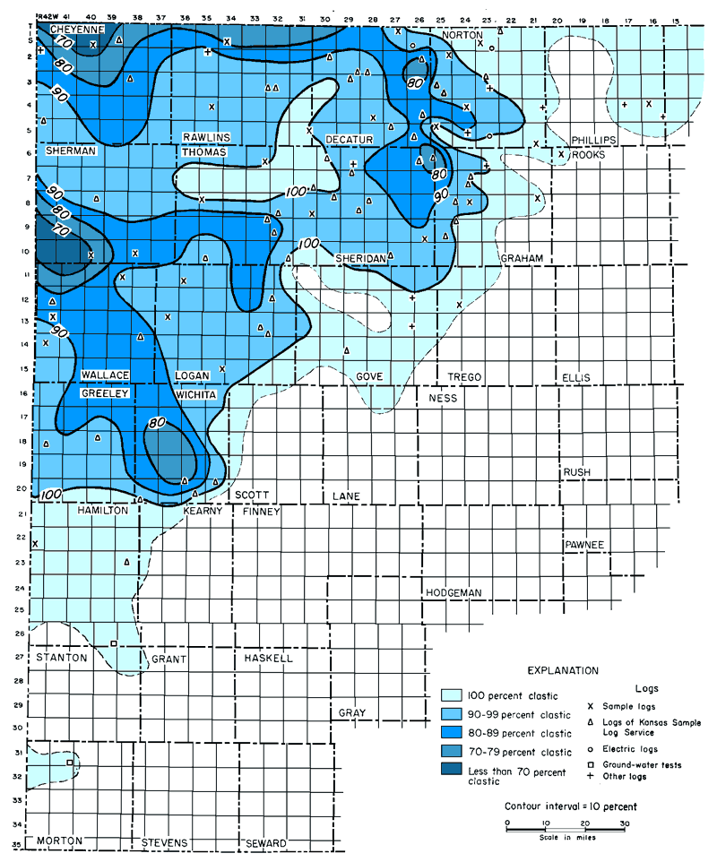
Figure 29--Clastic-percentage map of Morrison Formation (Jurassic) in western Kansas. Distribution of clastics suggests that beds were deposited by northwestward-flowing streams and that source of sediments was southeast (from Merriam, 1955a).
Kansas Geological Survey, Geologic History of Kansas
Comments to webadmin@kgs.ku.edu
Web version April 2006. Original publication date Dec. 1963.
URL=http://www.kgs.ku.edu/Publications/Bulletins/162/fig029.html