![]()
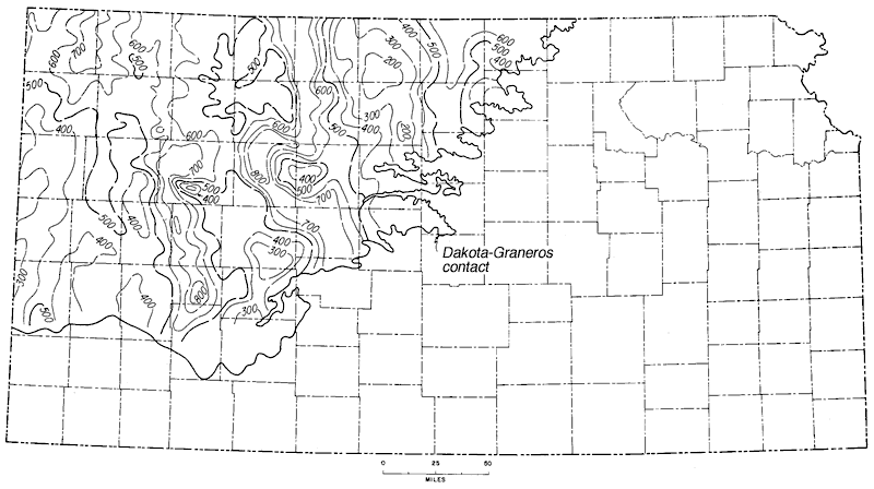
Figure 23
Figure 23--Isopachus map of beds between top of Dakota and base of Cretaceous. Inasmuch as the upper surface was essentially flat and horizontal and the lower surface is erosional, countours show position and shape of pre-Cretaaceous topographic features. Contour interval 100 feet.
Kansas Geological Survey, Geologic History of Kansas
Comments to webadmin@kgs.ku.edu
Web version April 2006. Original publication date Dec. 1963.
URL=http://www.kgs.ku.edu/Publications/Bulletins/162/fig023.html