![]()
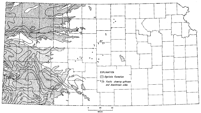
Figure 9
Figure 9--Convergence map showing restored thickness of Ogallala Formation from top of "Algal limestone" to top of Mesozoic bedrock. Crooked Creek, Fowler, Syracuse, Elkader, and Monument Rocks faults are shown. Contour interval 100 feet.
Kansas Geological Survey, Geologic History of Kansas
Comments to webadmin@kgs.ku.edu
Web version April 2006. Original publication date Dec. 1963.
URL=http://www.kgs.ku.edu/Publications/Bulletins/162/fig009.html