
Geology
The Hugoton Embayment represents the northern shelf-like extension of the Anadarko basin, consisting of a large (about 12,000 square miles; 31,080 square kilometers), southward-plunging trough bounded by uplifted areas on the west, north, and east. During the Permian, a series of 4th order transgressive-regressive cycles resulted in the deposition of interbedded deposits of carbonate (limestone and dolomite), shale, and nonmarine siltstones/shales and rarely sandstones. Sedimentary rocks thicken toward the middle of the basin and southward to about 9,000 feet (2,740 m) near the Kansas-Oklahoma border. Oil and gas wells drilled in the deepest part of the Hugoton in Kansas are over 5,000 feet (1,520 m) deep.
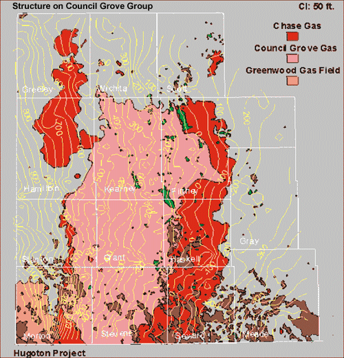
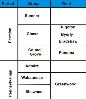
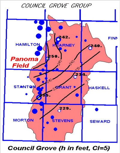
Gas is produced from the Permian Chase and Council Grove Groups. These same units crop out in the Flint Hills of eastern Kansas. The Hugoton, Byerly, and Bradshaw fields produce gas from the Chase Group. Council Grove Group production is restricted to the Panoma field that is underneath and geographically overlapped by the Hugoton field (Figure).
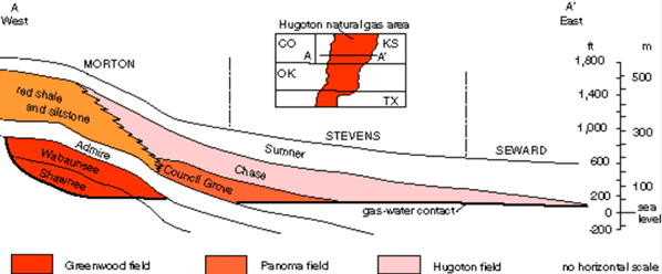
The rocks of the Chase and Council Grove Groups dip to the east-southeast because of the uplift of the Rocky Mountains to the west. Porous limestones and dolomites interfinger into red shales and siltstones sourced from the Rocky Mountains which form a seal. The top seal is provided by the overlying Sumner Group anhydrite and shale. The field is pinched off to the east where the Sumner Group meets the underlying ground water.
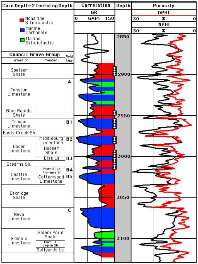
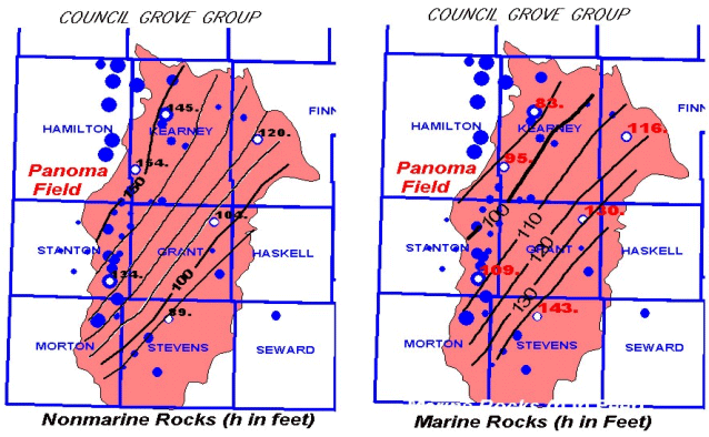
The Council Grove thins from 250 ft (76 m) in the west to 230 ft (70 m) in the east. Cumulative nonmarine rock thickness increases from 100 ft (30 m) in the east to over 150 ft (45 m) in the west. Carbonate thickness exhibits a complementary increase to the east.
Last updated June 2004
http://www.kgs.ku.edu/PRS/publication/2001-33/P1-05.html