
The Role of Evaporation Dissolution
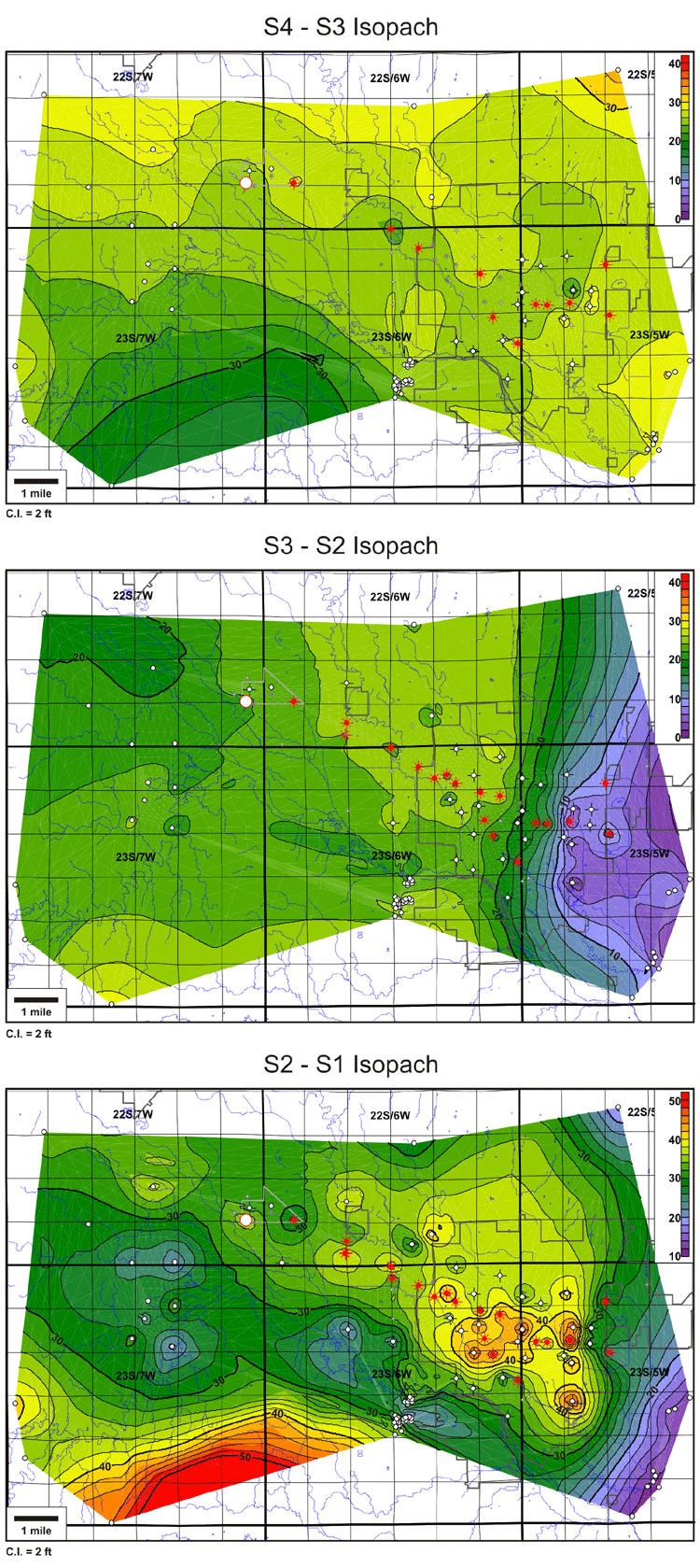
A series of isopach maps of the upper Hutchinson Salt Member shows significant thinning in the upper two salt intervals (S3-S2 and S2-S1) at the eastern edge of the study area. This thinning parallels the northeast-trending main salt-dissolution front. In addition, the S2-S1 interval (and to a lesser degree, the S3-S2 interval) exhibits a 1-2-mile-wide zone of northwest-trending thinning, which follows the Arkansas River to the south and west of Hutchinson. This feature appears to be an extension of the northwest trend in the main salt-dissolution front.
Last updated June 2004
http://www.kgs.ku.edu/PRS/publication/2004/AAPG/NG_Migration/P2-02.html