
The Role of Evaporation Dissolution
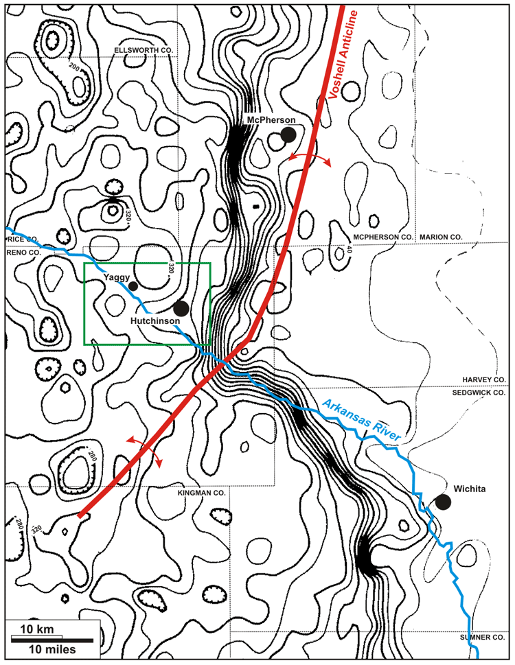
A net-salt isopach map of the Hutchinson Salt Member (Watney and Paul, 1980) shows that the Hutchinson-Yaggy study area (green box) lies within 10 miles of the main salt-dissolution front (closely spaced contours). The axis of the Voshell Anticline, a prominent faulted anticline affecting Paleozoic strata and believed to be related to north-northeast-trending salt dissolution, is shown. A local, northwest trend in the salt-dissolution front between Hutchinson and Wichita coincides with the course of the Arkansas River, which continues along this linear trend for 50 miles to the northwest.
 Click
on Image for Detail
Click
on Image for Detail
Last updated June 2004
http://www.kgs.ku.edu/PRS/publication/2004/AAPG/NG_Migration/P2-01.html