|
Type Log Database Tables
This web page presents the Database Tables for the Type Log Project. The Table holds
all the data necessary to build and display the Log ASCII Standard (LAS) 3.0 files
of the wells in this project.
Author: John R. Victorine
Released: 15 April 2013
|

|
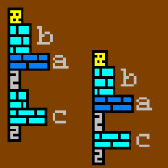
Kansas Stratigraphic Units
This chart was created to explain the Stratigraphic Units used for the
Type Logs Project. In many cases many of the units that are listed in
this chart are considered "informal", i.e. Excello Shale Member is used
in many of the Tops for Kansas Wells, but is not listed in the Official
Kansas Stratigraphic Units Chart. Many of the Stratigraphic Units that
are mentioned in the Type Logs Project are units that Geologist are most
familiar with and can be traced back to outcrops or to core descriptions.
To follow this logic this web site was created to display many of the
measured sections or core descriptions that have been published by Kansas
Geological Survey and will be used here to represent the Stratigraphic Units
that are part of the Type Logs Project.
Author: John R. Victorine
Released: 30 January 2013
|

|
PROFILE
The Profile Plot Applet was created to load Log ASCII Standard (LAS) version 2.0
or 3.0 Files from the Kansas Geological Survey (KGS) Server, to retrieve the Type
Log Tops Data and create a profile plot by depth. The user also has the ability
add an ASCII geologist report (measured section, core or cuttings descriptions) file.
The user can verify the data is complete before creating a LAS version 3.0 file of
the selected well. The user can also create Portable Network Graphics (PNG) file
of the profile image, which is automatically displayed in a HTML with the option
to create a Portable Document File (PDF).
Author: John R. Victorine
Released: 14 February 2013
|

|
General Cross Section Map Applet
The General Cross Section Plot Applet allows the user to place multiple well profiles
on one plot (4 Maximum) to view the wells with Log ASCII Standard (LAS) version 3.0 files.
NOTE: This program will launch another applet with the KID's representing the
Wells selected. The browser will consider this as a pop-up and will require you to temporarily
disable your pop-up blocker.
Author: John R. Victorine
Released: 02 April 2013
|