
Bob Slamal Digital Type Logs Project
Help: Township-Range-Section (TRS) Grid Map Control & Plot
|
|
Bob Slamal Digital Type Logs ProjectHelp: Township-Range-Section (TRS) Grid Map Control & Plot |
|
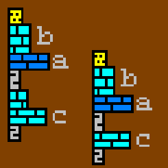
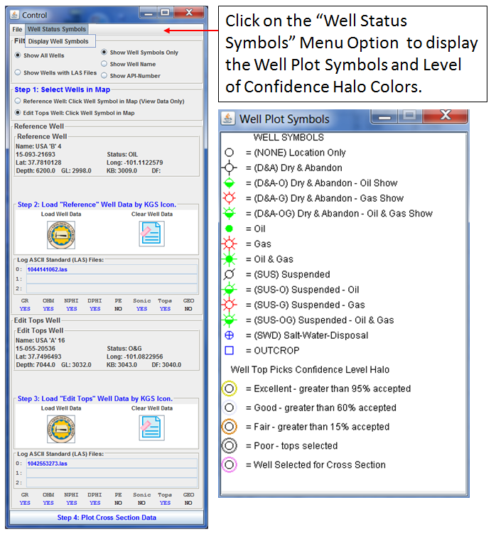
The Following symbols are used to identify the data that is loaded in for each Well,
| Select a button from the following list to view Help pages. | |||
|---|---|---|---|
 |
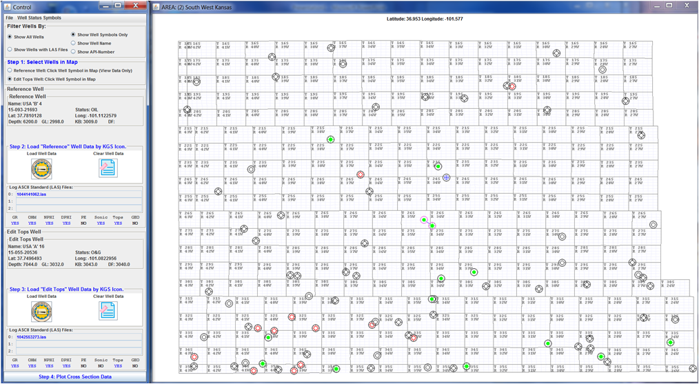
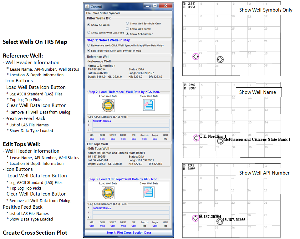
Step 1: Select Wells in Map
This section will take you through the steps to select two wells, one is a reference well (view only) and the second is the edit tops well, that will allow the user the ability to add/modify or accept/reject Type Log Tops picks. |
||
|
|
Step 2: Load "Reference" Well Data by KGS Icon
This section will take you through the steps to load a Reference Well Data. When you click on the Kansas Geological Survey (KGS) "Load Well Data" Icon Button the Type Log Tops Picks are loaded first and you should see "YES" below the Tops Column at the bottom of the "Reference Well" Panel. |
||
|
|
Step 3: Load "Edit Tops" Well Data by KGS Icon
This section will take you through the steps to load a Edit Tops Well Data. When you click on the Kansas Geological Survey (KGS) "Load Well Data" Icon Button the Type Log Tops Picks are loaded first and you should see "YES" below the Tops Column at the bottom of the "Edit Tops Well" Panel. |
||
|
Step 4: Plot Cross Section Data
This button will build the cross section plot once the two wells data are loaded. Below each well panel is a series of Mnemonics, i.e., GR, OHM, NPHI ..., there will be a blue "YES" if the data type is loaded. Note: For each well a "type of log file" will be determine and the plot tracks will be selected and displayed accordingly, Hierarchy of "Type of Log"
|
||
Author: John R. Victorine jvictor@kgs.ku.edu
The URL for this page is http://www.kgs.ku.edu/PRS/Ozark/TYPE_LOG/HELP/well_map/index.html