
Kansas Earthquakes 3D Plot
Description
Description
|
|
Description |
| Main Page | Applet | Download | Help | Copyright & Disclaimer | |
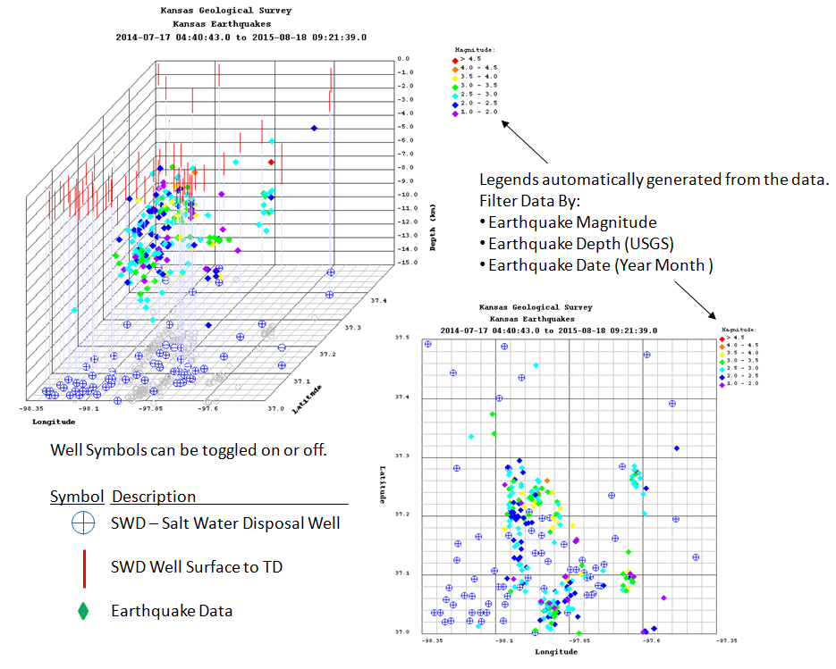
This applet is a 2 & 3 dimensional plot of Kansas Earthquakes in Sumner and Harper Counties. The Earthquake data is stored in the "gis_webinfo earthquakes" ORACLE Database Table on the Kansas Geological Server.
The plot displays the data collected from 17 July 2014 to present. The data is accessed using an ORACLE PL/SQL Stored Procedure http://chasm.kgs.ku.edu/ords/iqstrat.ks_earthquakes_pkg.getXML
You can download a "CSV" output from the ORACLE Database, which can be saved as a Comma Separated Values (CSV) File to your PC, with the following link, http://chasm.kgs.ku.edu/ords/iqstrat.ks_earthquakes_pkg.build_csv_page
This applet also plots the Wellington Seismic Array as "Triangles" in the 2 & 3 dimensional plot. This data is accessed using an ORACLE PL/SQL Stored Procedure http://chasm.kgs.ku.edu/ords/iqstrat.co2_events_pkg.getXML
You can download a "CSV" output from the ORACLE Database, which can be saved as a Comma Separated Values (CSV) File to your PC, with the following link, http://chasm.kgs.ku.edu/ords/iqstrat.co2_events_summary_pkg.build_csv_all_page
The plot also displays SWD (Salt Water Disposal) Wells that penetrate the Arbuckle Formation or are greater than 5,500 feet in depth. The data is accessed using an ORACLE PL/SQL Stored Procedure http://chasm.kgs.ku.edu/ords/iqstrat.ks_earthquakes_swd_pkg.getXML
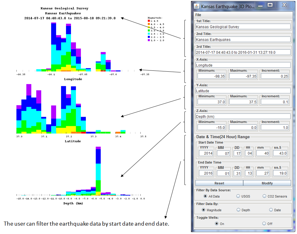
The applet allows the user to change the titles and the Latitude, Longitude and Depth Limits of the plot. The user can plot the data by color of the earth quake dataset by Earthquake Magnitude, Depth of the Event determined by USGS and the Date (Year and Month). A number of Salt Water Disposal (SWD) Wells are also plotted.
 |
 |
Author: John R. Victorine jvictor@kgs.ku.edu
The URL for this page is http://www.kgs.ku.edu/PRS/Ozark/Software/KS_Earthquake_3DPlot/index.html