
Kansas Earthquakes 3D Animation
Description
Description
|
|
Description |
| Description | Java Source Download | Website Download | Copyright & Disclaimer | |
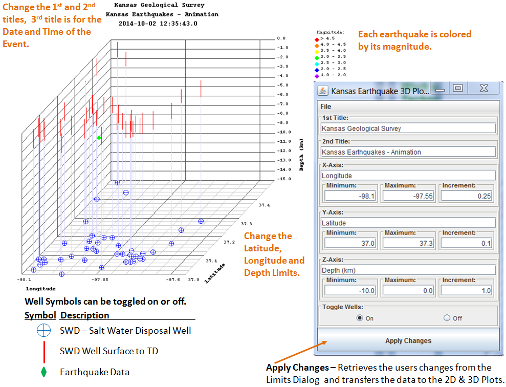
This applet is a animated 2 & 3 dimensional plot of Kansas Earthquakes in Sumner and Harper Counties. The Earthquake data is stored in the "gis_webinfo earthquakes" ORACLE Database Table on the Kansas Geological Server. The Animation Control Dialog will allow the user to change the limits of Latitude, Longitude and Depth ranges and to turn on or off the well symbols in the plot.
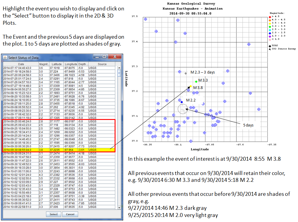
The plot displays the data collected from 17 July 2014 to present. The data is accessed using an ORACLE PL/SQL Stored Procedure http://chasm.kgs.ku.edu/ords/iqstrat.ks_earthquakes_pkg.getXML
The plot also displays SWD (Salt Water Disposal) Wells that penetrate the Arbuckle Formation or are greater than 5,500 feet in depth. The data is accessed using an ORACLE PL/SQL Stored Procedure http://chasm.kgs.ku.edu/ords/iqstrat.ks_earthquakes_swd_pkg.getXML
Plot Animation Control |
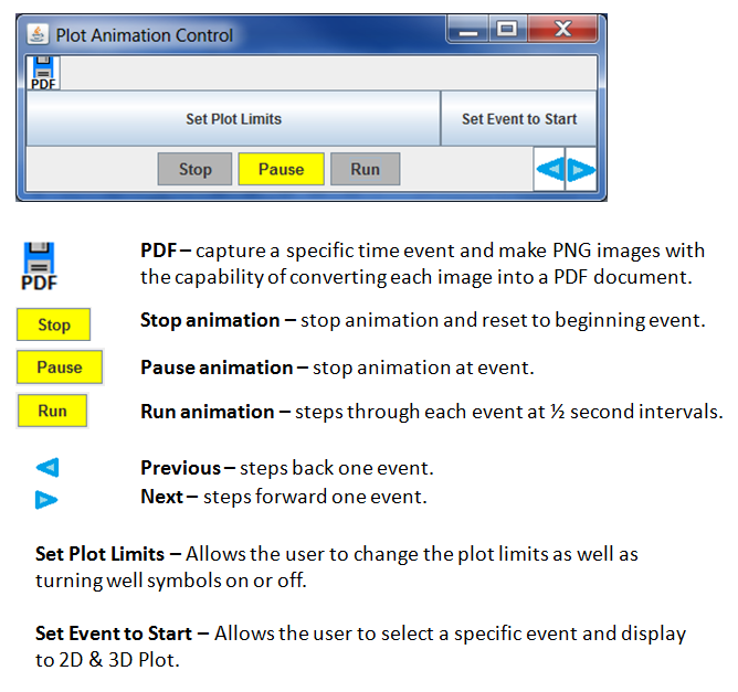 |
Set Plot Limits Button |
 |
Set Event to Start Button |
 |
| Author: John R. Victorine jvictor@kgs.ku.edu
The URL for this page is http://www.kgs.ku.edu/Ozark/JAVA_SRC/3DMovie/index.html |
 |
 |