http://www.kgs.ku.edu/PRS/AAPG2005/forestcity/p2-01.html
Last Modified August 2005
|
Stratigraphic Architecture of Lower to Middle Pennsylvanian Coal-beds in the Forest City Basin of Northeastern Kansas |
Kansas Geological Survey |
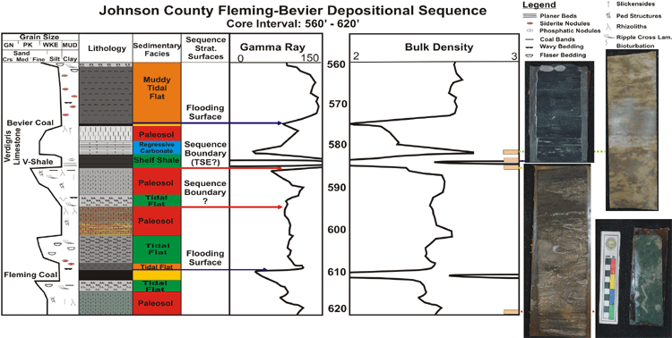
Fleming to Bevier Interval
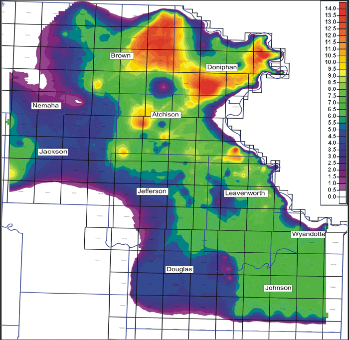
Isopachous map (in color scale) of net coal from the upper Cabaniss Formation of the Cherokee Group (Fleming, Croweburg, Bevier). The typical depositional sequence of the succession is based on cores and related log response. The net thickness of coal increases to the north and greater accumulations occur on the east side of the basin. High sulfur and moderate ash values indicate both marine water influence and influx of other sediment. Carbonate development is more prominent in this interval of the Cherokee Group and fluvial incision is rare, thus a carbonate influence is likely. Locally, peat growth in structural lows was negatively impacted by sediment influx making carbonaceous shales common lateral facies equivalents of coal that developed on structural highs where peat development was in mires protected from marine influence. Aerial extent, thickness and geometry of each of the coals indicate a coastal depositional setting, yet thick and thin linear trends of coals within the Fleming coal may indicate alluvial influence.
http://www.kgs.ku.edu/PRS/AAPG2005/forestcity/p2-01.html
Last Modified August 2005