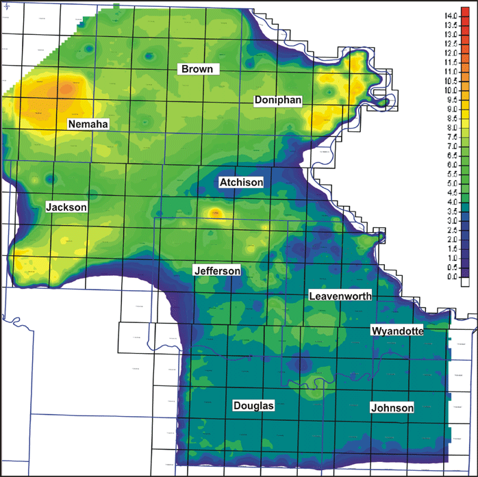
Riverton - Rowe Net Coal Isopach Map
http://www.kgs.ku.edu/PRS/AAPG2005/forestcity/p1-03.html
Last Modified August 2005
|
Stratigraphic Architecture of Lower to Middle Pennsylvanian Coal-beds in the Forest City Basin of Northeastern Kansas |
Kansas Geological Survey |
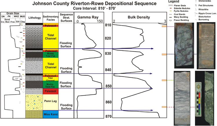
Isopachous map (in color scale) of net coal from the basal 4-7 coals of the Cherokee Group (Riverton, Aw, Bw, Cw, Neutral, and Rowe). The typical depositional sequence of the succession is based on cores and related log response. The net thickness of coal increases to the northwest associated with increased depth of the underlying Mississippian limestones. High sulfur and moderate ash values (pyritization and sideritization) indicate both marine influence (sulfur) and influx of other terrigenous or carbonate sediment (ash). No carbonates have been observed in this interval and thus coals with ash content likely are from clastic sources. Locally, peat growth in structural lows was negatively impacted by sediment influx making carbonaceous shales common lateral facies equivalents of coal, which developed on structural highs where mires protected it from marine influence.
http://www.kgs.ku.edu/PRS/AAPG2005/forestcity/p1-03.html
Last Modified August 2005