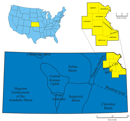
The Forest City Basin is located in the central mid-continent (USA) occupying some 20,000 mi2 (~52,000 km2) in NE Kansas, NW Missouri, SW Iowa, and SE Nebraska. The basin is bound to the south by the Bourbon Arch, to the west by the Nemaha Uplift, to the east by the Ozark Dome and to the north by the Transcontinental Arch. Cherokee Group (Atokan - Desmoinesian, early to middle-Pennsylvanian) rocks, in which most of the coals are imbedded, gradually thicken to the north and west into the deeper basin. During the early to early-Desmoinesian the Forest City Basin was influenced by the orogenic activity of the convergent Ouachita system in present-day southeastern Oklahoma such that the Nemaha fault system was actively creating substantial topography on the karsted Mississippian surface (Ham and Wilson, 1967). Deposition of the Cherokee Group occurred while the area was part of a slowly subsiding, intracratonic basin (Staton, 1987). Early to middle Pennsylvanian strata disconformably overlie the Mississippian limestone surface throughout the mid-continent (Saueraker, 1966).
 |
 |
| Location map of Nemaha, Brown, Doniphan, Jackson, Jefferson, Leavenworth, Wyandotte, Douglas, and Johnson counties. |
Stratigraphic column of Middle Pennsylvanian (Desmoinesian) strata in the study area. |
Depositional Environments
While depositional environments of many coals are not necessarily directly related to the environments of the overlying or underlying sediments (due to possible hiatus in deposition (McCabe, 1984)), depositional environments of overlying and underlying sediments must be identified in order to better understand variations in coal quality, thickness, and lateral extent within a sequence stratigraphic framework. Other factors, such as coal geometry, average thickness, aerial extent, orientation, ash content, and sulfur content also can give strong clues about coal depositional environment.
Click on above image for more detail
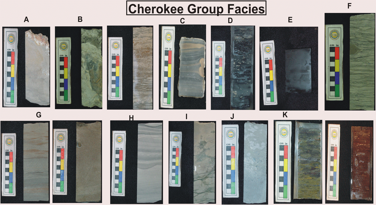
Core samples of Cherokee Group facies; (A) Mississipian Limestone; (B) Mississippian-Pennsylvanian Unconformity related facies (C) Sideritic gray shale; interpreted as shallow brackish water environment; (D) Pyritic gray shale; interpreted as shallow brackish water environment; (E) Phosphatic black shale, interpreted as “deep” water shelf shale associated with sediment starvation and maximum flood; (F) Ripple cross laminated heterolithic sandy shale, interpreted as tidal rythmites or tidal flats; (G) Sandstone interpreted as fluvial and deltaic environments, (H) Siltstone, intepreted as central estuarine low energy environment, (I), Bioclastic wackestone, interpreted as below wave base; (J)Bioclastic and Peloidal packstone and grainstone, interpreted as above wave base; (K)Pedogenically altered parent material, interpreted as paleosol indicating subaerial exposure
http://www.kgs.ku.edu/PRS/AAPG2005/forestcity
Last Modified August 2005