Slide 7 of 23
Notes:
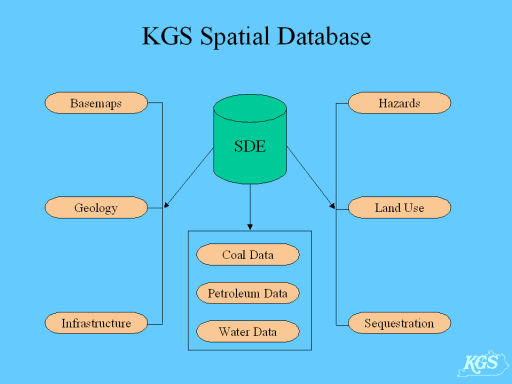
The MIDCARB project coincided with efforts at the Kentucky Geological Survey to construct its own SDE database. Several design elements evolved during the development process.
Existing spatial data covered a wide spectrum of natural resource themes and were large in number. It was decided to maintain these data in a single SDE database, using subtables for organizing the data thematically. This approach alleviated the necessity for users to make multiple database connections required by a multiple database scenario.
Data layers were prepared in a single coordinate system and datum, NAD83 decimal degrees, to simplify integration. Features were added as SDE layers - no geodatabase functionality has yet been enabled.
The KGS enterprise point databases (oil, gas, coal, and water well and measurement locations) that are maintained in the RDBMS were spatially enabled in SDE by adding their location information as SDE layers.