Putting it all together
The integration of geoscience data by quantitative methods
Previous--Polygonal Estimation Method ||
Next--Maps of South Central Sector
PCB Example 4
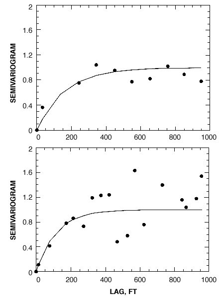
Experimental semivariograms in the direction of the river's flow,
and across the river's flow, for south-central section. Spherical model is shown.
Previous--Polygonal Estimation Method ||
Next--Maps of South Central Sector