


Kansas Geological Survey, Open-file Report 2000-31
Figure 13
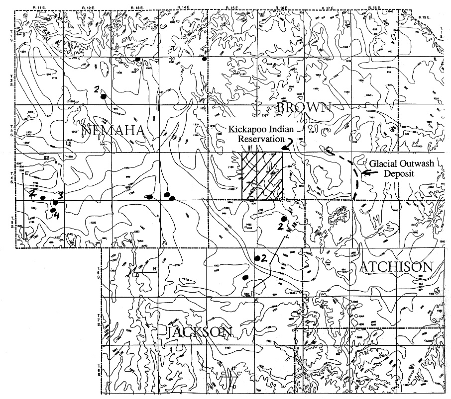
Figure 13. Map of the subsurface bedrock topography in Nemaha, Brown,
western Doniphan, northern Jackson, western Atchison, and northwestern Jefferson
counties in northeastern Kansas from Denne et al (1998). A major
northwest-southeast trending buried valley system is present beneath the glacial
deposits in Nemaha and northern Jackson counties. The axis of this buried valley
system is within a few miles of the southwestern edge of the Kickapoo Indian
reservation. Shown on the map as dots are the public water-supply well locations
taken from the WWC-5 records of water-well completion. The numbers next to the
dots indicate the number of wells at each location. Shown by a dashed line also
is the trend of a glacial outwash deposit in Brown County taken from Bayne and
Schowe (1967).
Return to report
Kansas Geological Survey, Geohydrology
Placed online December 2000
Comments to webadmin@kgs.ku.edu
The URL for this page is HTTP://www.kgs.ku.edu/Hydro/Publications/OFR00_31/figure13.html