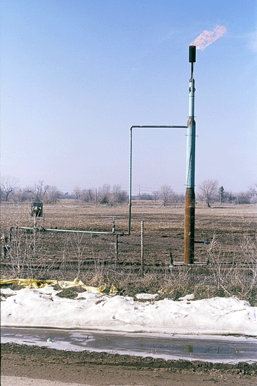
Flaring vent well
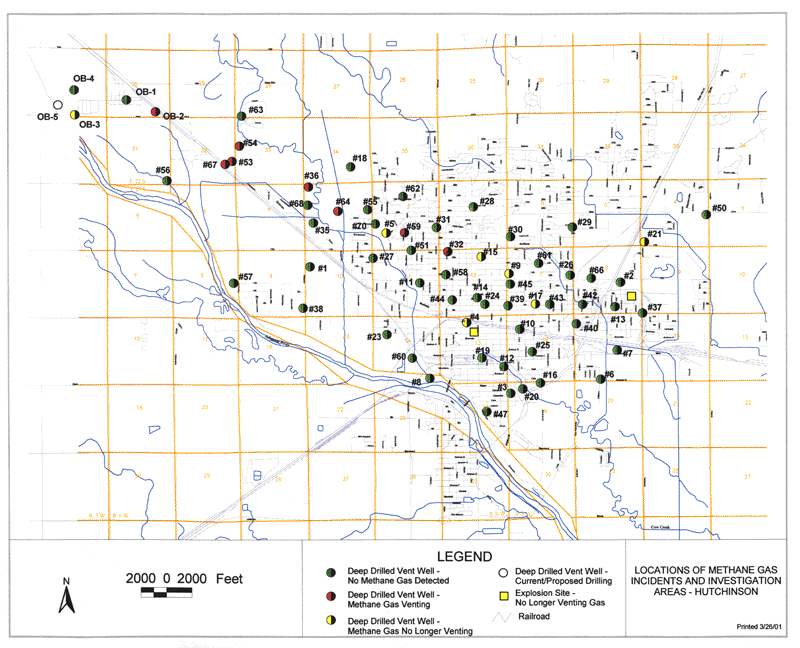
Location and status of vent wells (map provided by Kansas
Department of Health and Environment)
(updated map coming soon)
The Hutchinson News reported on Friday, March 2nd, that seven wells were currently
burning gas. Following is a list of the flares and the reported average daily
volume of gas they were burning as of Tuesday, February 27th:
- 18th and Halsey--348,000 cubic feet per day.
- (#53) Wilson Road, 0.2 mile north of K-96--136,200 cubic feet per day.
- (#54) Wilson Road, 0.5 mile north of K-96--93,200 cubic feet per day.
- 30th and Pennington--84,300 cubic feet per day.
- 16th and Madison (Cub Square Park)--19,970 cubic feet per day.
- 7th and Pershing--13,290 cubic feet per day.
- Rice Park--843 cubic feet per day.
- Include Table of locations?
- Include flow, pressure, time data as received.
Prev Topic--Shallow Seismic Reflection Survey ||
Next Topic--Groundwater Monitoring
Kansas Geological Survey, Hutchinson Response Project
Updated March 21, 2001
Web comments to webadmin@kgs.ku.edu
URL=http://www.kgs.ku.edu/Hydro/Hutch/Vent/index.html


