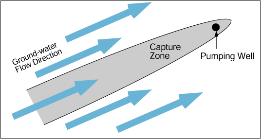
If there is a hydraulic gradient the cone of depression shape in map view is parabolic with the open end of the parabola pointed up the hydraulic gradient. The ground water flowing into this region supplies the well with water as it is being pumped.
The well is capturing the flow in order to continue to produce water. The area inside this parabolic shape is referred to as the well's capture zone.