![]()
Back to Recharge from Precipitation... || or use your Browser's "Back" command
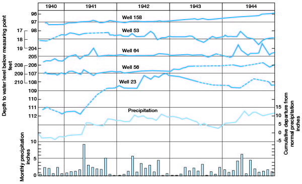
Figure 7
Figure 7--Hydrographs showing the fluctuations of the water levels in five wells in Seward County, the cumulative departure from normal monthly precipitation at Liberal, and the monthly precipitation at Liberal. A smaller version of this figure is available.
Back to Recharge from Precipitation... || or use your Browser's "Back" command
Kansas Geological Survey, Geohydrology
Web version Sept. 2001. Original publication date March 1948.
Comments to webadmin@kgs.ku.edu
The URL for this page is http://www.kgs.ku.edu/General/Geology/Seward/fig3.html