![]()
Plates
Plate I--Geologic map of Cloud County, Kansas. Also available as an Acrobat PDF version (7 MB).
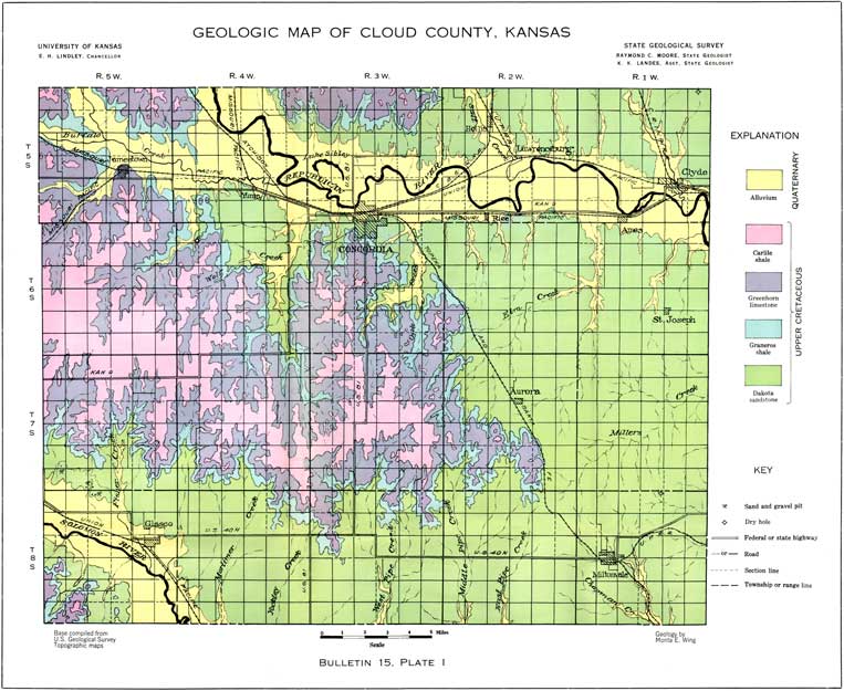
Plate II--Geologic map of Republic County, Kansas. Also available as an Acrobat PDF version (7 MB).
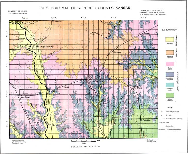
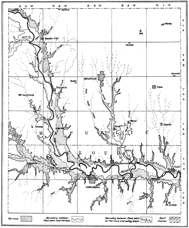
Plate III--Map of lower flood plain and terrace of Republican River. Also available as an Acrobat PDF version (440 kB).
Kansas Geological Survey, Geology
Placed on web July 24, 2008; originally published May 1930.
Comments to webadmin@kgs.ku.edu
The URL for this page is http://www.kgs.ku.edu/General/Geology/Republic/06_plates.html