DPA Help
This page presents help on navigating through the Digital Petroleum Atlas.
|
| |
|
|
DPA HelpThis page presents help on navigating through the Digital Petroleum Atlas. |
![]()
|
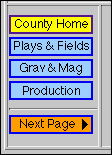
Several counties have been analyzed in depth for the DPA. These buttons on the County
pages allow the user to move through the different kinds of information found. The
Yellow Button shows the user which part they are currently viewing.
For example, all of the geologic maps for a county will have a yellow "County Home" button. Clicking on that button will take you to the first geologic map page (if there is more than map page). |
|
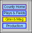
In this case the yellow button shows that the user is viewing the Gravity and Magnetic
pages of the county. The user will be able to select a specific map using other navigation
not shown here.
The "Plays and Fields" button presents a list of all the plays present in the county and the all the fields in that play. The "Production" button shows the annual oil and gas production for the county of interest. |
|
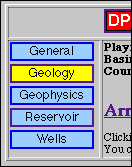
Topic Buttons
The information for each oil and gas field has been split into several topics. The "General" pages describe the exploration history, production, engineering parameters, and other general information. The "Geology" pages show a series of structure and isopach maps for the field. The "Geophysics" pages have gravity and magnetics maps, pseudo-seismic data, and other geophysical data. The "Reservoir" pages have production pages, core analyses and photos, and petrophysical analysis plots. The "Wells" area has pages for every well in the field. Well and lease production, digital well logs, completion forms, and other well-specific info can be found there. |
|
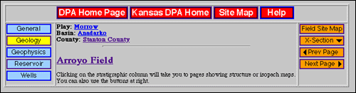
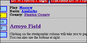
Text Links to Regional Info
In the center of each Field Navigation area is a set of text links. Clicking on the Field Name will take the user to the starting page for that field. The user can also move to pages concerning regional data. Play, Basin, and Counties information is found using the text links. |
|
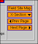
Local Buttons
For some Topics, the information will be split into a series of pages. Local Buttons can be used to move from page to page. For example, each field has several geology pages showing structure and isopach maps. The user can move from one horizon to the next using the orange local buttons. Some of the fields have a "Field Site Map" to assist in navigation. It is similar to the full DPA Site Map except the scope is limited to the field in question. |
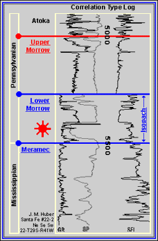
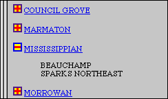
| On county and field geology pages, you will find a stratigraphic chart. The chart is used primarily to show the user what stratigraphic horizon is being mapped. However, it is also a navigation tool. Clicking on a Blue circle or text link will take the user to a new structure map, cross section, or isopach map. |
|
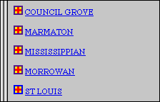
On Play lists, clicking on a |
|