![]()
Use your "Back..." command to return to the page you were viewing.
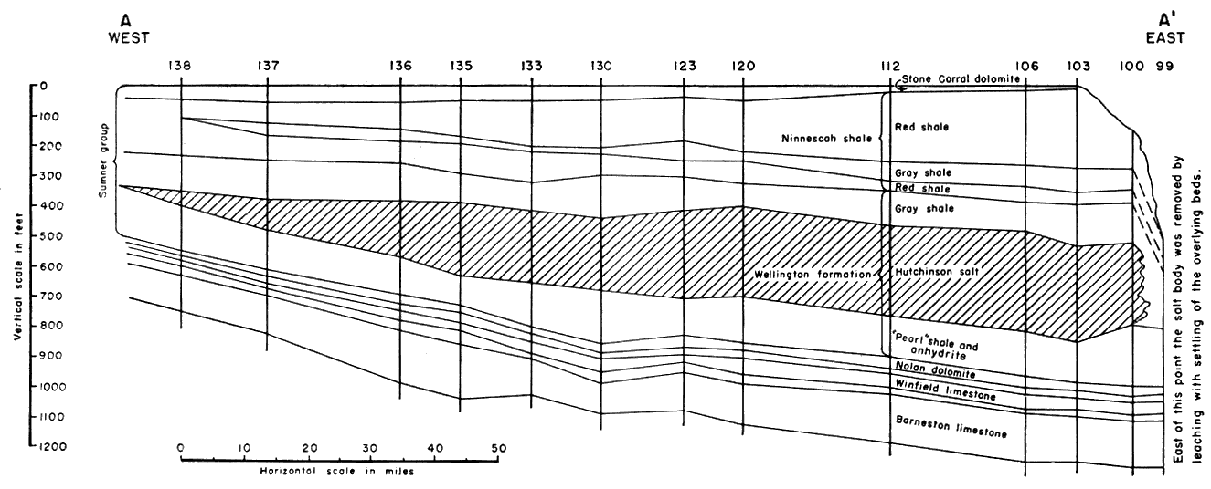
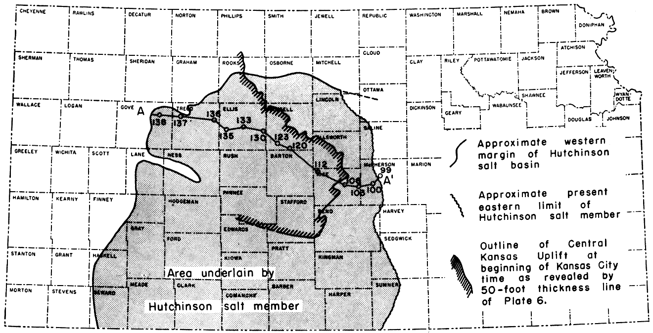
Figure 7
Fig. 7--Stratigraphic cross section of the Sumner group of the Permian (after Kellet, 1932) on line A-A' of insert showing eastward thickening of the Hutchinson salt member of the Wellington formation and an inset showing the salt basin crossing the Central Kansas uplift. The wells are correlated on the top of the Stone Corral dolomite. The numbers of the wells are the same as those used on the original Kellett cross section. The cross section reveals that the salt lens originally extended a considerable but undeterminable distance to the east or southeast. The Central Kansas uplift which had been a positive and rising area since St. Peter time, was a subsiding area during this interval. The present attitude of the salt in the Salina basin is shown on cross sections X-X' and Y-Y' (Pls. 13 and 14) and on the original Kellett cross section.
Use your "Back..." command to return to the page you were viewing.
Kansas Geological Survey, Geology
Placed on web Dec. 28, 2007; originally published Nov. 1948.
Comments to webadmin@kgs.ku.edu
The URL for this page is http://www.kgs.ku.edu/Publications/Bulletins/74/fig7.html