![]()
![]()
![]()
Kansas Geological Survey, Open File Report 97-14
Digital Petroleum Atlas Annual Report 1996
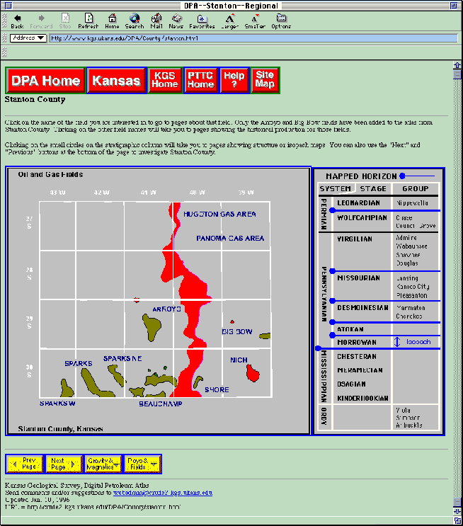
Figure 9. County map and geologic column for Stanton County, Kansas (http://www.kgs.ku.edu/DPA/County/stanton.html). Both the geologic column and the county map are graphical user interfaces that can access additional geologic and petroleum information. Ia addition buttons below mp can be used to access additional information.