


Kansas Geological Survey, Open File Report 96-50
Seismic Modeling in the Minneola Complex, part 4 of 10
Single-Well Model Interpretation
The single well model uses the Statton #1-12 well and various
modified versions of this well to build a pseudo-cross section
which shows a relatively thin Morrow-Mississippian channel-fill
interval (21 ft. 6.4 m.) that contains a moderately thick sand
(9 ft.; 2.7 m) in the middle of the channel, flanked by a shale
section that thins to a 2 ft. (0.6 m.) Morrow-Mississippian
interval outside of the channel (Fig. 4a). Correlated tops include
the Marmaton (MRMT), Cherokee (CHRK), Atoka (ATOK), Morrow (MRRW),
and Mississippian (MISS). The model extends above the Marmaton but
is not shown to focus on the area of interest. The Morrow sandstone
interval is represented in the unmodified version of the well. The
shale filled part of the channel was created by connecting the log
curve above and below the sandstone interval with a straight line.
Note that in this well the sandstone has a higher velocity than the
shale, even though the sandstone is porous and filled with gas.
This is typical of the high-impedance productive sandstones found
in the Minneola complex and suggests an isochron anomaly should be
detected between a channel filled with just shale and one that
contains a sandstone. The channel edges were created by replacing
all but the top 2 ft. (0.6 m.) of the original Morrow-Mississippian
interval with the Mississippian limestone velocity and bulk density.
Figure 4a--Single well model cross section. Sonic
curves are red and bulk density curves are blue. Vertical scale in
feet below sea level. Horizon (tops) abbreviations are Marmaton
(MRMT), Cherokee (CHRK), Atoka (ATOK), Morrow (MRRW) and
Mississippian (MISS).
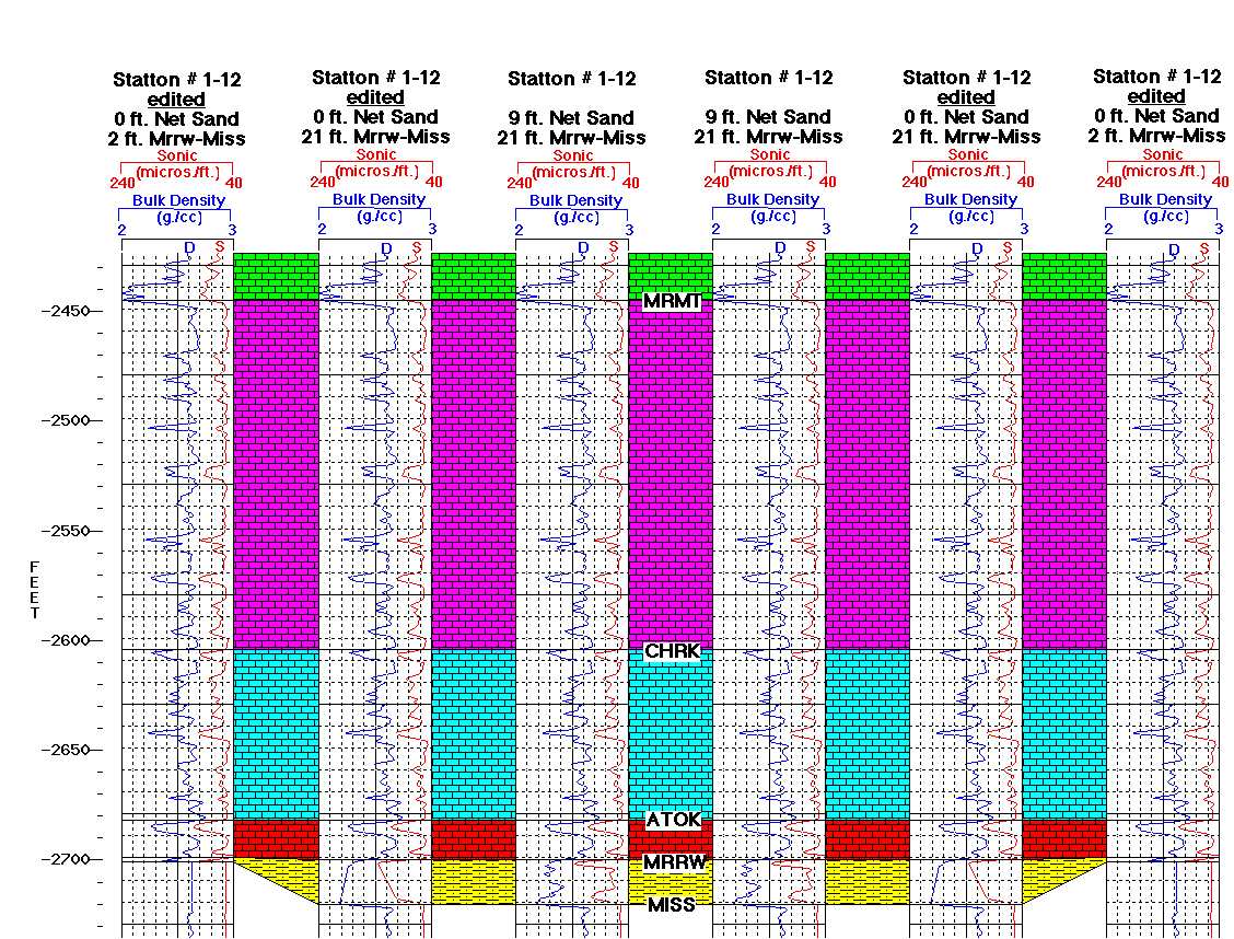
Figure 4b--Interpolated single well acoustic
impedance model. Reds represent limestones, sandstones, and
higher velocity shales. Yellows and oranges represent lower
velocity shales. Vertical scale in seconds of two-way travel
time from the top of the model and is approximately twice that
of the seismic models. A black and white
verion of this plot is available.
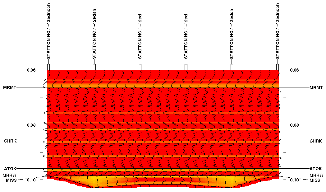
Figure 4c--Same as Figure 4b but with a vertical
scale approximately the same as the seismic models.
A black and white verion of this plot is
available.
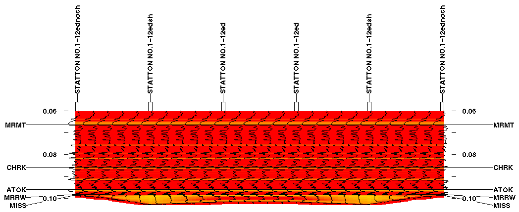
The log interpolation model of this cross section is shown as a
vertically expanded version in Figure 4b and at the same scale as
the synthetic seismic section in Figure 4c. Note that the curves
and colors in the log interpolation model represent acoustic
impedance values which are the product bulk density and velocity.
Also note that the vertical scale is in two-way travel time from
the top of the model. The darker reds represent higher impedance
values (mostly from limestone, sandstone, and high velocity/density
shales. The oranges and yellow represent low velocity and density
shales. Although the thickness interval is the same for both the
shale and sandstone filled channel wells, there is an isochron
thickening in the shale filled channel wells compared to that
containing the sandstone due to the lower velocity of the shale.
Report Contents ||
Previous Page--Seismic Modeling ||
Next Page--Lower Resolution Single-Well Model
Kansas Geological Survey, Open-File Report 96-50
Placed online Feb. 1997
Comments to webadmin@kgs.ku.edu
URL=http://www.kgs.ku.edu/PRS/publication/OFR96_50/rep4.html