
Kansas Geological Survey
Open-file Report 2001-55
|
|
|
Kansas Geological Survey Open-file Report 2001-55 |
To gain an understanding of the paleogeomorphology of the Arbuckle
surface it was necessary to accurately reconstruct paleotopography.
It is important to determine if relief on present Arbuckle structure
represents an actual erosion surface, or if it has been modified
by subsequent deformation.By generating structure and interval
isopach maps using well defined markers above the unconformity,
one can understand and remove the effects of younger deformational
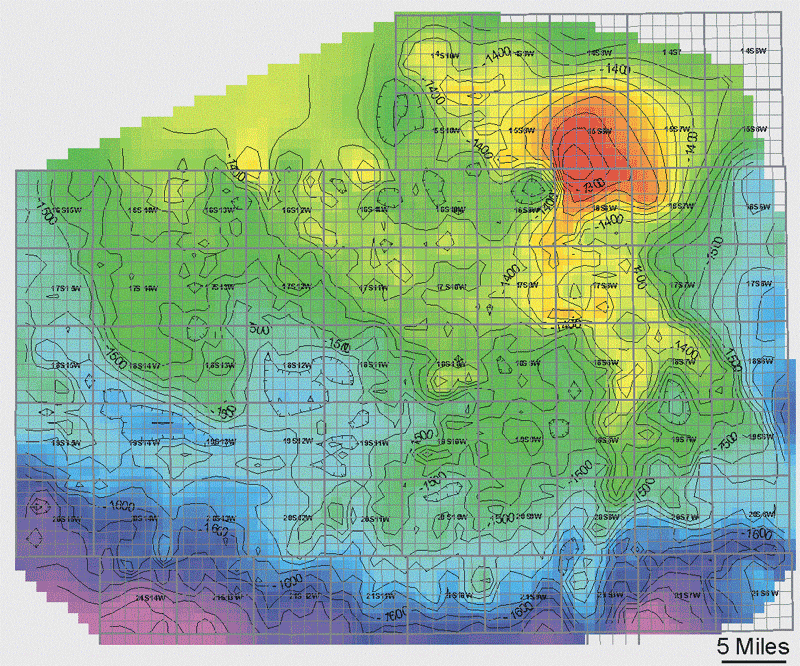
events. The structure map of the Base of Kansas City (Missourian)
shows minor structural trends from earlier deformation, but the
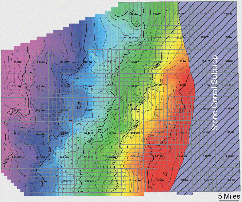
structure map on the Stone Corral (Permian) shows a much more
subdued structure with only regional tilting.
The interval isopach between the Stone Corral and Base of Kansas City was used to quantify and remove the effects of Post-Desmoinesian deformation. A regional trend was obtained by fitting an azimuth and dip magnitude to the isopach map. A representative dip direction trending N38 W was chosen in the direction of isopach thinning. Along that fitted line it was calculated that 300 feet (91 meters) of thinning occured over approximately 25 miles (40 km), producing a regional dip magnitude of 0.13.
Base of Kansas City Structure
Contour Interval: 20 Feet
Stone Corral Structure
Contour Interval: 20 Feet
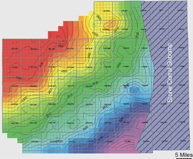
Stone Corral - Base of KC Isopach
Contour Interval: 20 Feet
|
|
|
e-mail : webadmin@kgs.ku.edu
Last updated January 2002
http://www.kgs.ku.edu/PRS/publication/OFR2001-55/P1-07.html