
Kansas Geological Survey
Open-file Report 2001-38
|
|
|
Kansas Geological Survey Open-file Report 2001-38 |
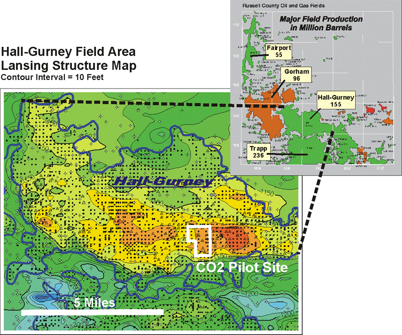
Structure contour map depicts the current structural variation in a eighty square mile area (ten miles wide by eight miles tall) covering the main portion of the Hall-Gurney Field. The structure on the Lansing reflects that of the L-KC "C" zone and is a result of drape over a strong pre-Pennsylvanian structure. Pre-Pennsylvanian strata was stripped away exposing the Precambrian over much of the apex of the field.
|
|
|
e-mail : webadmin@kgs.ku.edu
Last updated December 2001
http://www.kgs.ku.edu/PRS/publication/OFR2001-38/P1-07.html