 |
|
Kansas Geological Survey Open-file Report 2003-51 |
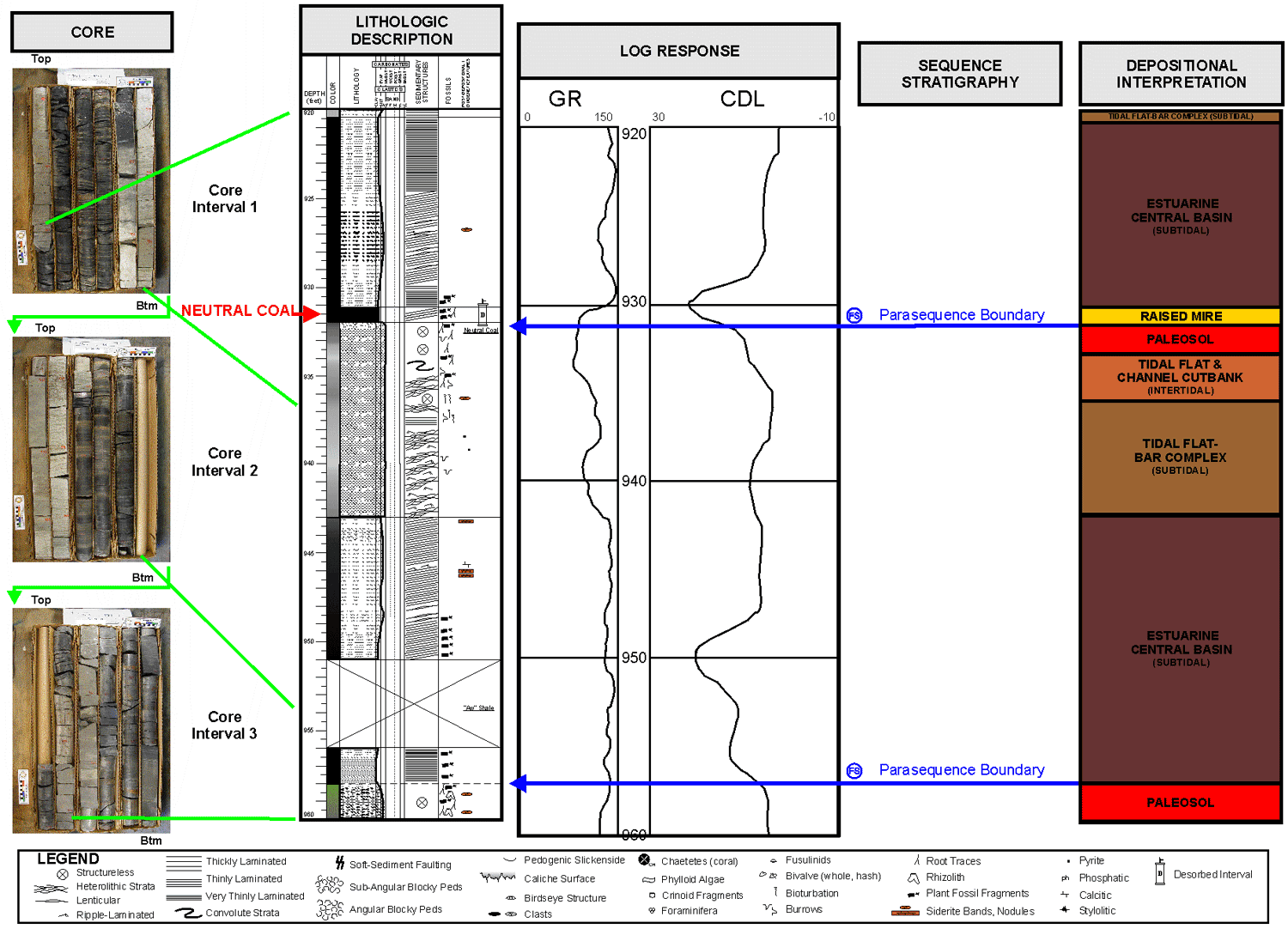
Neutral Coal
The Neutral appears continuous over the study area except where it was eroded by the incised lower Bartlesville sandstone. In Miami County, the Neutral coal overlies bar and channel deposits of a tidal flat prograding over a near-coastal estuarine central basin--a cycle repeated once directly beneath and twice directly above this interval. Ash from this core and sulfur data from a Cass County, Missouri, core indicate that the peat likely formed as a slightly raised mire. The mire was somewhat protected from detrital influx with little marine influence upon flooding. A possible modern analogue would be the Malaysian tidal coastlines and mires of Coleman et al. (1970).
Click on above image to show more detail
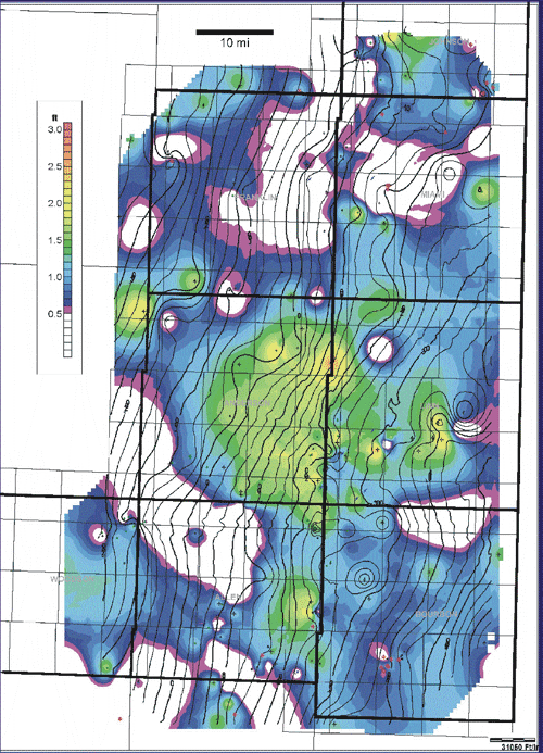 |
Neutral Coal Isopach Map (C.I. = 0.1 ft.) with Neutral Structure Overlay (C.I. = 25 ft.) |
|
|
|
e-mail : webadmin@kgs.ku.edu
Last updated October 2003
http://www.kgs.ku.edu/PRS/publication/MidAAPG2003-1/P2-02.html