 |
|
Kansas Geological Survey Open-file Report 2003-51 |
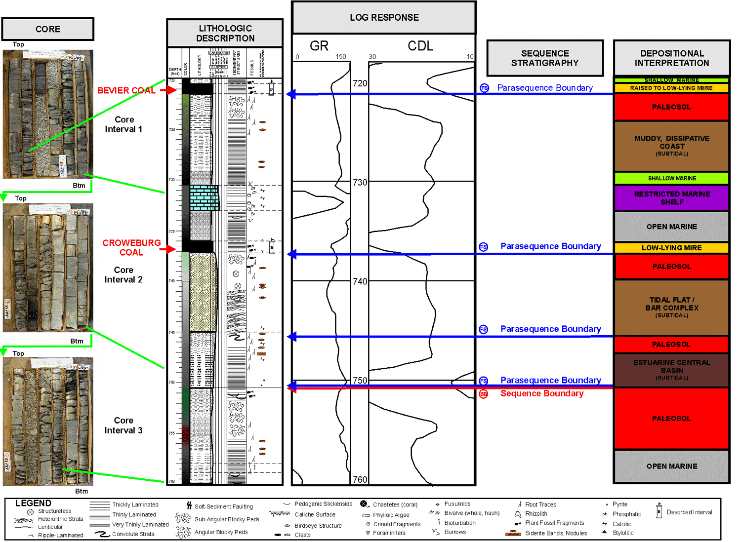
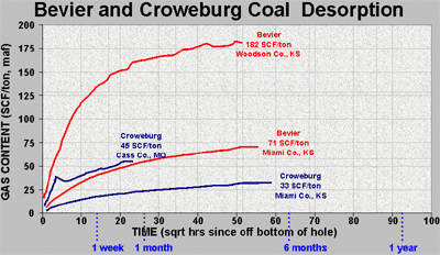
Bevier & Croweburg Coals
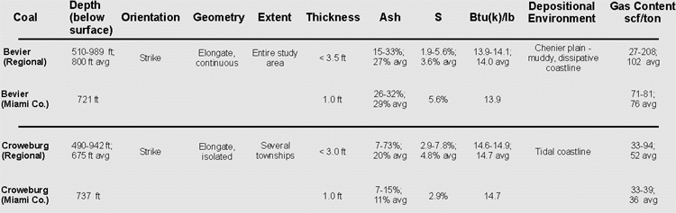
The Bevier coal tends to be elongate and parallel to the paleoshoreline, and is extensive and very continuous. In Miami County, the Bevier rests on laminated, bioturbated siltstone and shale interpreted to be the deposits of a low-energy, dissipative, muddy coast similar to the modern-day Orinoco delta and Venezuelan coast (van Andel, 1967; Wells and Coleman, 1981). Regional ash and sulfur data indicate that the Bevier possibly formed as raised mires in some areas.
The Croweburg coal tends to also be elongate, but less continuous than the Bevier, and also parallels the paleoshoreline. In this particular core location the Croweburg overlies a heterolithic, tide-influenced sand, which in turn overlies laminated sandy-silt and siltstone. This interval is interpreted to represent a prograding tidal flat overlain by a low to slightly raised mire with possible coast-oriented tidal-barrier sands within the region. This would be analogous to the modern-day Snuggedy Swamp of South Carolina (Staub and Cohen, 1979).
Click on above image to show more detail
 |
 |
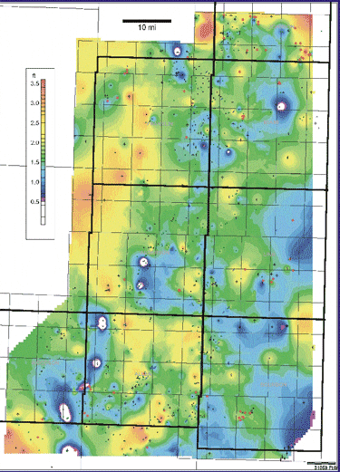
Bevier Coal Isopach (C.I. = 0.1 ft.) |
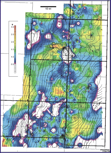
Croweburg Coal Isopach (C.I. = 0.1 ft) with Croweburg Structure Contour Overlay (C.I. = 25 ft) |
|
|
|
e-mail : webadmin@kgs.ku.edu
Last updated October 2003
http://www.kgs.ku.edu/PRS/publication/MidAAPG2003-1/P2-01.html