Kansas Geological Survey, Open-file Report 2004-39
Index of Images || Small Web Image || Acrobat PDF (730K)
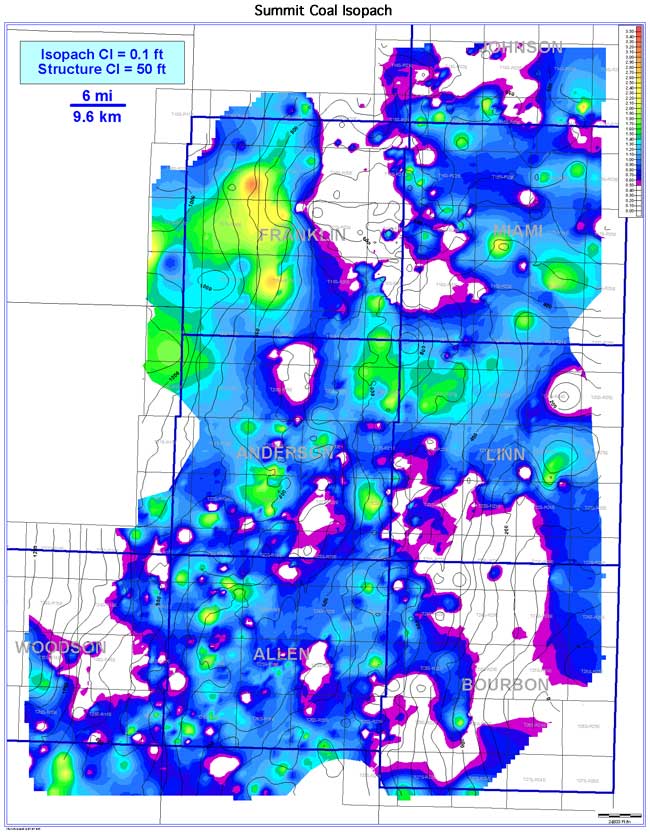
The Summit coal exhibits a circular, pod-like coal seam geometry oriented NW-SE. Estimated seam extent of 4,071 sq mi (10,543 sq km) is less than that of the Mulky coal. Coal-seam continuity also is less than that of the Mulky coal (1,511 sq mi [3,913 sq km]), and approximately 37.1% of seam extent. Thickness in the Bourbon arch ranges from 0 to 3.2 ft (0 to 1.0 m), with a mean of 0.8 ft (0.2 m). Thicker areas of the Summit occur in localized parts of Allen, Anderson, northern Linn, Miami, and Franklin counties. Relationships to underlying strata vary across the study area. The coal isopach exhibits thinning into structural lows and thickening over structural highs in the southern portion of the area when superimposed on the structure contours of the underlying Blackjack Creek Limestone Member. In contrast, thicker coal is associated with underlying structural lows, while structural highs exhibit thinning of the Summit coal in the northern portion of the study area.