Kansas Geological Survey, Open-file Report 2004-39
Index of Images || Small Web Image || Acrobat PDF (649K)
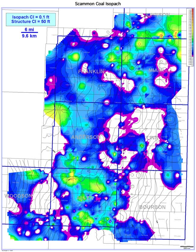
The Scammon coal exhibits an elongate seam geometry that is generally oriented parallel to depositional dip (southwest). Coal extent is estimated to be 3,780 sq mi (9,790 sq km). Coal continuity is estimated to be 1,307 sq mi (3,385 sq km), or 34.6% of the extent. Coal thickness in the Bourbon arch ranges from 0 to 3.3 ft (0 to 1.0 m); averaging 0.8 ft (0.3 m). The low continuity of the Scammon is attributed to proximity to active sedimentation of the Chelsea Sandstone Member. Consistently thicker coal trends occur in northern Allen, central Anderson, northern Miami, and southern Johnson counties. Comparison to the structure of the underlying Chelsea Sandstone Member shows little relation; the Scammon coal thickens over both structural highs and lows.