Kansas Geological Survey, Open-file Report 2004-39
Index of Images || Small Web Image || Acrobat PDF (565k)
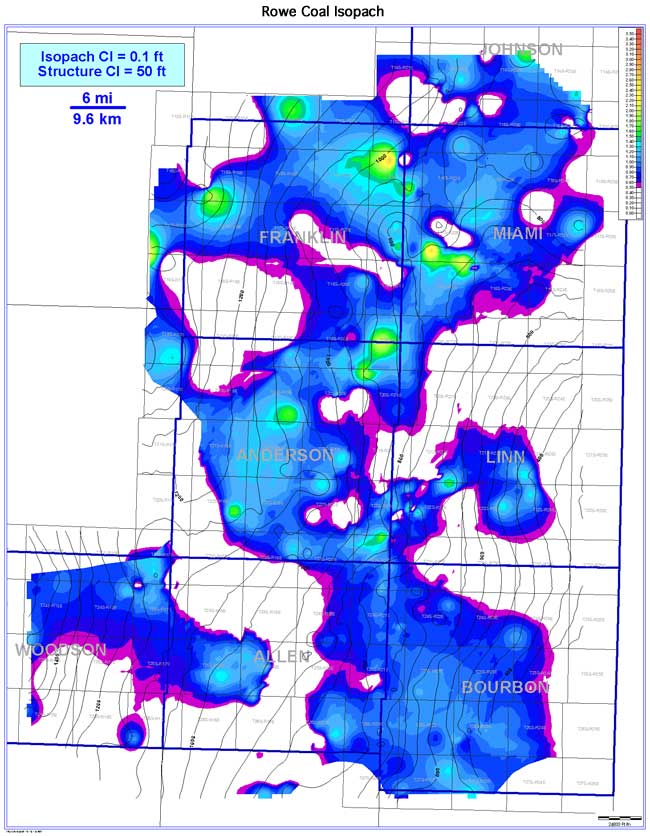
Similar to the Neutral, the Rowe coal exhibits a lenticular coal geometry oriented parallel to depositional strike (NW-SE). Coal extent is estimated to be 3,128 sq mi (8,102 sq km). Coal continuity is estimated to be 747 sq mi (340 sq km), or 23.9% of the extent. Thickness of the Rowe coal in the Bourbon arch ranges from 0 to 2.7 ft (0 to 0.8 m), averaging 0.6 ft (0.2 m). Consistently thicker coal trends occur in central Anderson, western Bourbon, western Miami, and northeastern Franklin counties. As with the Neutral coal, the Rowe coal tends to thicken on highs and thin into lows of Mississippian structure.