Kansas Geological Survey, Open-file Report 2004-39
Index of Images || Small Web Image || Acrobat PDF (649K)
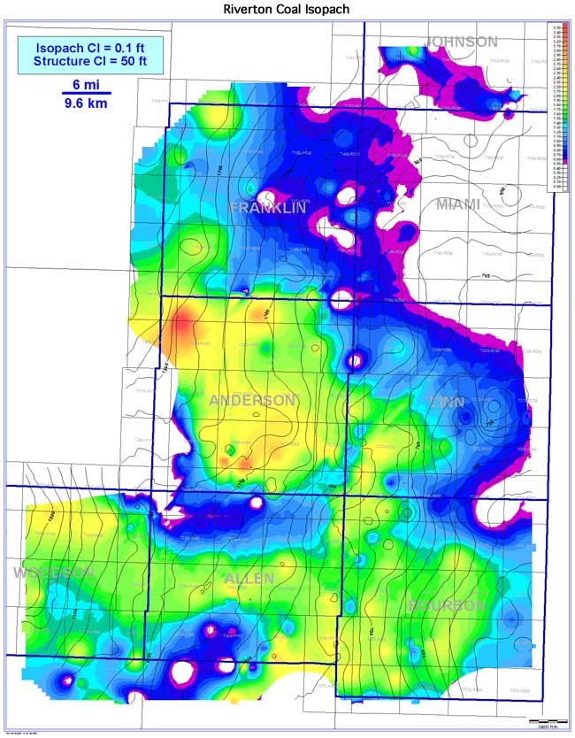
Digital subsurface mapping of the Riverton coal reveals two thin, lenticular to elongate coal-seam geometries trending NW-SE. The Riverton coal extends an estimated 3,578 sq mi (9,267 sq km) across the Bourbon arch. The Riverton is estimated to be continuous over 2,461 sq mi (6,374 sq km; 68.8% of the extent). Thickness ranges from 0 to 3.7 ft (0 to 1.1 m), averaging 1.2 ft (0.4 m). Thick coal trends occur in Bourbon, Anderson, and Woodson counties. The Riverton coal pinches out northeastward into Miami County onto a regional Mississippian paleotopographic high. In general, the coal thickens on regional structural highs and thins into the regional lows. However, localized structural lows of the underlying Mississippian karst surface may show anomalously thick Riverton coal.